Villa de Zaachila geodata
Villa de Zaachila (Oaxaca) is a seat of a second-order administrative division; located in Mexico in America/Mexico_City (GMT-6) time zone. With population of 13,959 people, there are 693 cities with bigger population in this country. Compared to other cities in Mexico, 89.6% of cities are located further ↑North; 77.9% of cities are located further ←West and 51.8% of cities have lower elevation than Villa de Zaachila. Note1


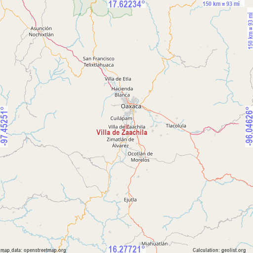
Villa de Zaachila GPS coordinates[2]
16° 57' 3.528" North, 96° 44' 57.768" West
| Map corner | latitude | longitude |
|---|---|---|
| Upper-left | 17.62234°, | -97.45251° |
| Center: | 16.95098°, | -96.74938° |
| Lower-right: | 16.27721°, | -96.04626° |
| Map W x H: | 149.6×149.6 km | = 93×93mi |
| max Lat: | 32.7° ⇑89.6% North |
| Villa de Zaachila: | 16.95098° |
| min Lat: | ⇓10.4% South 14.53588° |
| min Long | Villa de Zaachi | max Long |
| -117.105° | -96.74938° | -86.73105° |
| W 77.9%⇐ | ⇒22.1% E |
Elevation
Elevation of Villa de Zaachila is 1518 m = 4980 ft, and this is 264.3 m = 867 ft above average elevation for this country.
| Max E: |
3497 m = 11473 ft | 48.2% |
| Villa de Zaachila | 1518 m 4980 ft | |
| Avg. | 1253.7 m = 4113 ft | |
Min E: |
-1 m = -3 ft | 51.8% |
See also: Mexico elevation on elevation.city.
Geographical zone
Villa de Zaachila is located in North Torrid zone (between Equator and Tropic of Cancer). Distance of this Northern Tropic circle is 721.1 km =448.1 mi to North.| Distance of | km | miles | from Villa de Zaachila |
|---|---|---|---|
| North Pole | 8122.3 | 5047 | to North |
| Arctic Circle | 5516.4 | 3427.7 | to North |
| Tropic Cancer | 721.1 | 448.1 | to North |
| Equator | 1884.8 | 1171.2 | to South |


Nearby cities:
15 places around Villa de Zaachila: (largest is in red/bold)
• Barrio la Guadalupe
4.7 km =2.9 mi,  221°
221°
• Cuarta Sección
5.1 km =3.2 mi,  103°
103°
• Cuilapan de Guerrero
4.5 km =2.8 mi,  311°
311°
• Emiliano Zapata
3.9 km =2.4 mi,  116°
116°
• Fraccionamiento Real del Valle
2.8 km =1.7 mi, 224°
• Reyes Mantecón
5.4 km =3.4 mi,  153°
153°
• San Bartolo Coyotespec
4.3 km =2.7 mi,  79°
79°
• San Isidro Monjas
5.6 km =3.5 mi,  0°
0°
• San Juan Bautista la Raya
4.7 km =2.9 mi,  33°
33°
• San Miguel Tlanichico
4 km =2.5 mi,  242°
242°
• San Raymundo Jalpam
2.4 km =1.5 mi,  340°
340°
• Santa María Coyotepec
5 km =3.1 mi,  69°
69°
• Santa María Roaló
4.6 km =2.9 mi,  214°
214°
• Trinidad Zaachila
3.6 km =2.2 mi, 205°
• Vicente Guerrero
5.5 km =3.4 mi,  111°
111°
Sources, notices
• [Note1] Compared only with cities in Mexico existing in our database
• [Src1] Map data: © OpenStreetMap contributors (CC-BY-SA)
• [Src2] Other city data from geonames.org with taken over terms of usage.
• [Src3] Geographical zone / Annual Mean Temperature by Robert A. Rohde @ Wikipedia
