San Antonio Pachuquilla geodata
San Antonio Pachuquilla (State of Mexico) is a populated place; located in Mexico in America/Mexico_City (GMT-6) time zone. With population of 589 people, there are 14579 cities with bigger population in this country. Compared to other cities in Mexico, 67.4% of cities are located further ↑North; 62% of cities are located further →East and 72.9% of cities have lower elevation than San Antonio Pachuquilla. Note1
Current local time in San Antonio Pachuquilla:
11:19 AM, MondayDifference from your time zone: hours


San Antonio Pachuquilla GPS coordinates[2]
18° 53' 3.012" North, 99° 50' 20.004" West
| Map corner | latitude | longitude |
|---|---|---|
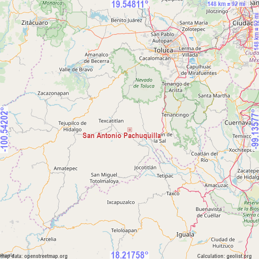
| Upper-left | 19.54811°, | -100.54202° |
| Center: | 18.88417°, | -99.83889° |
| Lower-right: | 18.21758°, | -99.13577° |
| Map W x H: | 147.9×147.9 km | = 91.9×91.9mi |
| max Lat: | 32.7° ⇑67.4% North |
| San Antonio Pachuquilla: | 18.88417° |
| min Lat: | ⇓32.6% South 14.53588° |
| min Long | San Antonio Pac | max Long |
| -117.105° | -99.83889° | -86.73105° |
| W 38%⇐ | ⇒62% E |
Elevation
Elevation of San Antonio Pachuquilla is 1988 m = 6522 ft, and this is 734.3 m = 2409 ft above average elevation for this country.
| Max E: |
3497 m = 11473 ft | 27.1% |
| San Antonio Pachuquilla | 1988 m 6522 ft | |
| Avg. | 1253.7 m = 4113 ft | |
Min E: |
-1 m = -3 ft | 72.9% |
See also: Mexico elevation on elevation.city.
Geographical zone
San Antonio Pachuquilla is located in North Torrid zone (between Equator and Tropic of Cancer). Distance of this Northern Tropic circle is 506.2 km =314.5 mi to North.| Distance of | km | miles | from San Antonio Pachuquilla |
|---|---|---|---|
| North Pole | 7907.3 | 4913.4 | to North |
| Arctic Circle | 5301.5 | 3294.2 | to North |
| Tropic Cancer | 506.2 | 314.5 | to North |
| Equator | 2099.7 | 1304.7 | to South |


Nearby cities:
15 places around San Antonio Pachuquilla: (largest is in red/bold)
• Acuitlapilco
6.3 km =3.9 mi,  64°
64°
• Agua Fría
4.5 km =2.8 mi,  237°
237°
• Almoloya de Alquisiras
6.2 km =3.9 mi,  250°
250°
• Chiltepec de Hidalgo
3.2 km =2 mi,  8°
8°
• Cruz de Piedra
6.7 km =4.2 mi,  22°
22°
• Cuauhtenco
5.7 km =3.5 mi, 236°
• Ixtlahuaca de Villada
5.1 km =3.2 mi,  40°
40°
• Las Vueltas
2.7 km =1.7 mi,  319°
319°
• Loma de Acuitlapilco
8.3 km =5.2 mi, 41°
• Primera de Analco
7 km =4.3 mi,  72°
72°
• San Andrés Tepetitlán
8.6 km =5.3 mi,  280°
280°
• San José Tizates
5.9 km =3.7 mi,  150°
150°
• San José del Progreso
7.4 km =4.6 mi, 41°
• Segunda de Analco (La Presa)
8.1 km =5 mi, 55°
• Texcapilla
9.1 km =5.7 mi, 319°
Sources, notices
• [Note1] Compared only with cities in Mexico existing in our database
• [Src1] Map data: © OpenStreetMap contributors (CC-BY-SA)
• [Src2] Other city data from geonames.org with taken over terms of usage.
• [Src3] Geographical zone / Annual Mean Temperature by Robert A. Rohde @ Wikipedia
