Cuauhtenco geodata
Cuauhtenco (State of Mexico) is a populated place; located in Mexico in America/Mexico_City (GMT-6) time zone. With population of 735 people, there are 11887 cities with bigger population in this country. Compared to other cities in Mexico, 67.9% of cities are located further ↑North; 62.5% of cities are located further →East and 71.8% of cities have lower elevation than Cuauhtenco. Note1


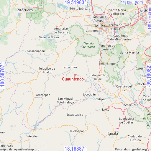
Cuauhtenco GPS coordinates[2]
18° 51' 20.052" North, 99° 53' 2.184" West
| Map corner | latitude | longitude |
|---|---|---|
| Upper-left | 19.51963°, | -100.58707° |
| Center: | 18.85557°, | -99.88394° |
| Lower-right: | 18.18887°, | -99.18082° |
| Map W x H: | 148×148 km | = 92×92mi |
| max Lat: | 32.7° ⇑67.9% North |
| Cuauhtenco: | 18.85557° |
| min Lat: | ⇓32.1% South 14.53588° |
| min Long | Cuauhtenco | max Long |
| -117.105° | -99.88394° | -86.73105° |
| W 37.5%⇐ | ⇒62.5% E |
Elevation
Elevation of Cuauhtenco is 1963 m = 6440 ft, and this is 709.3 m = 2327 ft above average elevation for this country.
| Max E: |
3497 m = 11473 ft | 28.2% |
| Cuauhtenco | 1963 m 6440 ft | |
| Avg. | 1253.7 m = 4113 ft | |
Min E: |
-1 m = -3 ft | 71.8% |
See also: Mexico elevation on elevation.city.
Geographical zone
Cuauhtenco is located in North Torrid zone (between Equator and Tropic of Cancer). Distance of this Northern Tropic circle is 509.4 km =316.5 mi to North.| Distance of | km | miles | from Cuauhtenco |
|---|---|---|---|
| North Pole | 7910.5 | 4915.4 | to North |
| Arctic Circle | 5304.6 | 3296.1 | to North |
| Tropic Cancer | 509.4 | 316.5 | to North |
| Equator | 2096.5 | 1302.7 | to South |


Nearby cities:
15 places around Cuauhtenco: (largest is in red/bold)
• Agua Fría
1.2 km =0.7 mi,  50°
50°
• Almoloya de Alquisiras
1.6 km =1 mi,  315°
315°
• Capula
8.2 km =5.1 mi,  281°
281°
• Chiltepec de Hidalgo
8.2 km =5.1 mi,  39°
39°
• Diego Sánchez
7.7 km =4.8 mi,  247°
247°
• Hueyatenco
9.6 km =6 mi,  292°
292°
• Las Vueltas
6 km =3.7 mi,  29°
29°
• Plan de Vigas
5.8 km =3.6 mi,  176°
176°
• San Andrés Tepetitlán
6.1 km =3.8 mi, 321°
• San Antonio Pachuquilla
5.7 km =3.5 mi,  56°
56°
• San Francisco
7.5 km =4.7 mi, 320°
• San José Tizates
7.9 km =4.9 mi,  104°
104°
• Sultepec
8.6 km =5.3 mi,  272°
272°
• Texcaltitlán
10.1 km =6.3 mi,  325°
325°
• Texcapilla
10.1 km =6.3 mi,  353°
353°
Sources, notices
• [Note1] Compared only with cities in Mexico existing in our database
• [Src1] Map data: © OpenStreetMap contributors (CC-BY-SA)
• [Src2] Other city data from geonames.org with taken over terms of usage.
• [Src3] Geographical zone / Annual Mean Temperature by Robert A. Rohde @ Wikipedia
