Santiago Acayutlán geodata
Santiago Acayutlán (Hidalgo) is a populated place; located in Mexico in America/Mexico_City (GMT-6) time zone. With population of 1,649 people, there are 5260 cities with bigger population in this country. Compared to other cities in Mexico, 61.3% of cities are located further ↓South; 54.1% of cities are located further →East and 72.9% of cities have lower elevation than Santiago Acayutlán. Note1


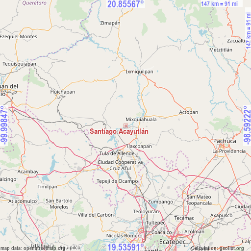
Santiago Acayutlán GPS coordinates[2]
20° 11' 49.884" North, 99° 17' 43.224" West
| Map corner | latitude | longitude |
|---|---|---|
| Upper-left | 20.85567°, | -99.99847° |
| Center: | 20.19719°, | -99.29534° |
| Lower-right: | 19.53591°, | -98.59222° |
| Map W x H: | 146.7×146.7 km | = 91.2×91.2mi |
| max Lat: | 32.7° ⇑38.7% North |
| Santiago Acayutlán: | 20.19719° |
| min Lat: | ⇓61.3% South 14.53588° |
| min Long | Santiago Acayut | max Long |
| -117.105° | -99.29534° | -86.73105° |
| W 45.9%⇐ | ⇒54.1% E |
Elevation
Elevation of Santiago Acayutlán is 1986 m = 6516 ft, and this is 732.3 m = 2403 ft above average elevation for this country.
| Max E: |
3497 m = 11473 ft | 27.1% |
| Santiago Acayutlán | 1986 m 6516 ft | |
| Avg. | 1253.7 m = 4113 ft | |
Min E: |
-1 m = -3 ft | 72.9% |
See also: Mexico elevation on elevation.city.
Geographical zone
Santiago Acayutlán is located in North Torrid zone (between Equator and Tropic of Cancer). Distance of this Northern Tropic circle is 360.2 km =223.8 mi to North.| Distance of | km | miles | from Santiago Acayutlán |
|---|---|---|---|
| North Pole | 7761.3 | 4822.6 | to North |
| Arctic Circle | 5155.5 | 3203.5 | to North |
| Tropic Cancer | 360.2 | 223.8 | to North |
| Equator | 2245.7 | 1395.4 | to South |


Nearby cities:
15 places around Santiago Acayutlán: (largest is in red/bold)
• Atengo
4.1 km =2.5 mi,  233°
233°
• Colonia San Juan
1.5 km =0.9 mi,  120°
120°
• Huitel
3.8 km =2.4 mi,  152°
152°
• La Cruz
6.1 km =3.8 mi,  112°
112°
• La Loma
4 km =2.5 mi, 123°
• La Palma
4.7 km =2.9 mi,  62°
62°
• Mangas
5.1 km =3.2 mi,  103°
103°
• Panuaya
2.6 km =1.6 mi, 95°
• San Gabriel
5 km =3.1 mi,  235°
235°
• San Isidro el Tanque
2.6 km =1.6 mi,  160°
160°
• San Juan Achichilco
2.9 km =1.8 mi,  224°
224°
• Santa María Batha
5.4 km =3.4 mi, 56°
• Tenango
3.4 km =2.1 mi,  8°
8°
• Tepeitic
4.9 km =3 mi, 5°
• Tezontepec de Aldama
2.3 km =1.4 mi, 108°
Sources, notices
• [Note1] Compared only with cities in Mexico existing in our database
• [Src1] Map data: © OpenStreetMap contributors (CC-BY-SA)
• [Src2] Other city data from geonames.org with taken over terms of usage.
• [Src3] Geographical zone / Annual Mean Temperature by Robert A. Rohde @ Wikipedia
