La Parada geodata
La Parada (San Luis Potosí) is a populated place; located in Mexico in America/Mexico_City (GMT-6) time zone. With population of 576 people, there are 14877 cities with bigger population in this country. Compared to other cities in Mexico, 81.5% of cities are located further ↓South; 56.4% of cities are located further →East and 60.8% of cities have higher elevation than La Parada. Note1


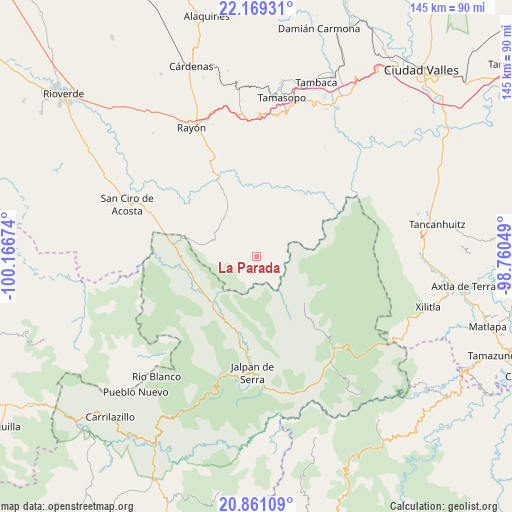
La Parada GPS coordinates[2]
21° 31' 0.012" North, 99° 27' 48.996" West
| Map corner | latitude | longitude |
|---|---|---|
| Upper-left | 22.16931°, | -100.16674° |
| Center: | 21.51667°, | -99.46361° |
| Lower-right: | 20.86109°, | -98.76049° |
| Map W x H: | 145.5×145.5 km | = 90.4×90.4mi |
| max Lat: | 32.7° ⇑18.5% North |
| La Parada: | 21.51667° |
| min Lat: | ⇓81.5% South 14.53588° |
| min Long | La Parada | max Long |
| -117.105° | -99.46361° | -86.73105° |
| W 43.6%⇐ | ⇒56.4% E |
Elevation
Elevation of La Parada is 950 m = 3117 ft, and this is 303.7 m = 996 ft below average elevation for this country.
| Max E: |
3497 m = 11473 ft | 60.8% |
| Avg. | 1253.7 m = 4113 ft | |
| La Parada | 950 m = 3117 ft | |
Min E: |
-1 m = -3 ft | 39.2% |
See also: Mexico elevation on elevation.city.
Geographical zone
La Parada is located in North Torrid zone (between Equator and Tropic of Cancer). Distance of this Northern Tropic circle is 213.5 km =132.7 mi to North.| Distance of | km | miles | from La Parada |
|---|---|---|---|
| North Pole | 7614.6 | 4731.5 | to North |
| Arctic Circle | 5008.7 | 3112.3 | to North |
| Tropic Cancer | 213.5 | 132.7 | to North |
| Equator | 2392.4 | 1486.6 | to South |


Nearby cities:
15 places around La Parada: (largest is in red/bold)
• Arroyo Seco
23.5 km =14.6 mi,  278°
278°
• Concá
19.5 km =12.1 mi,  245°
245°
• El Lindero
26.7 km =16.6 mi,  188°
188°
• El Pajarito
32.1 km =19.9 mi,  316°
316°
• El Puente (Ejido Guayabos)
20.4 km =12.7 mi,  356°
356°
• Lagunillas
13.4 km =8.3 mi,  307°
307°
• Pinihuan
24.3 km =15.1 mi,  333°
333°
• Purísima de Arista
23.4 km =14.5 mi, 192°
• San Diego (Pueblo Viejo)
3.3 km =2.1 mi,  228°
228°
• San Rafael
26.6 km =16.5 mi,  287°
287°
• Santa Catarina
15.9 km =9.9 mi,  348°
348°
• Santa María Acapulco
5.5 km =3.4 mi,  155°
155°
• Tanlacut (Labor Zapata)
22.3 km =13.9 mi,  38°
38°
• Valle Verde
30.1 km =18.7 mi,  90°
90°
• Valle de Guadalupe
31.4 km =19.5 mi,  119°
119°
Sources, notices
• [Note1] Compared only with cities in Mexico existing in our database
• [Src1] Map data: © OpenStreetMap contributors (CC-BY-SA)
• [Src2] Other city data from geonames.org with taken over terms of usage.
• [Src3] Geographical zone / Annual Mean Temperature by Robert A. Rohde @ Wikipedia
