Purísima de Arista geodata
Purísima de Arista (Querétaro) is a populated place; located in Mexico in America/Mexico_City (GMT-6) time zone. With population of 2,304 people, there are 3826 cities with bigger population in this country. Compared to other cities in Mexico, 80.1% of cities are located further ↓South; 57.1% of cities are located further →East and 64.5% of cities have higher elevation than Purísima de Arista. Note1


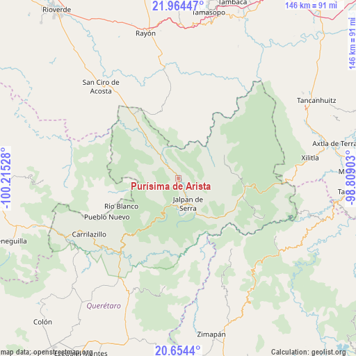
Purísima de Arista GPS coordinates[2]
21° 18' 39.24" North, 99° 30' 43.74" West
| Map corner | latitude | longitude |
|---|---|---|
| Upper-left | 21.96447°, | -100.21528° |
| Center: | 21.3109°, | -99.51215° |
| Lower-right: | 20.6544°, | -98.80903° |
| Map W x H: | 145.7×145.7 km | = 90.5×90.5mi |
| max Lat: | 32.7° ⇑19.9% North |
| Purísima de Arista: | 21.3109° |
| min Lat: | ⇓80.1% South 14.53588° |
| min Long | Purísima de Ar | max Long |
| -117.105° | -99.51215° | -86.73105° |
| W 42.9%⇐ | ⇒57.1% E |
Elevation
Elevation of Purísima de Arista is 717 m = 2352 ft, and this is 536.7 m = 1761 ft below average elevation for this country.
| Max E: |
3497 m = 11473 ft | 64.5% |
| Avg. | 1253.7 m = 4113 ft | |
| Purísima de Arista | 717 m = 2352 ft | |
Min E: |
-1 m = -3 ft | 35.5% |
See also: Mexico elevation on elevation.city.
Geographical zone
Purísima de Arista is located in North Torrid zone (between Equator and Tropic of Cancer). Distance of this Northern Tropic circle is 236.4 km =146.9 mi to North.| Distance of | km | miles | from Purísima de Arista |
|---|---|---|---|
| North Pole | 7637.5 | 4745.7 | to North |
| Arctic Circle | 5031.6 | 3126.5 | to North |
| Tropic Cancer | 236.4 | 146.9 | to North |
| Equator | 2369.5 | 1472.3 | to South |


Nearby cities:
15 places around Purísima de Arista: (largest is in red/bold)
• Ahuacatlán de Guadalupe
11.1 km =6.9 mi,  195°
195°
• Atarjea
22 km =13.7 mi,  257°
257°
• Concá
19.6 km =12.2 mi,  319°
319°
• El Lindero
3.7 km =2.3 mi,  162°
162°
• Encino Solo
26.3 km =16.3 mi,  103°
103°
• Jalpan
11.2 km =7 mi, 157°
• La Lagunita
27.2 km =16.9 mi,  105°
105°
• La Parada
23.4 km =14.5 mi,  12°
12°
• La Vuelta
28.3 km =17.6 mi, 95°
• Lagunillas
31.5 km =19.6 mi,  349°
349°
• Landa de Matamoros
24.4 km =15.2 mi,  125°
125°
• Pinal de Amoles
22.9 km =14.2 mi,  211°
211°
• San Diego (Pueblo Viejo)
20.8 km =12.9 mi, 7°
• Santa María Acapulco
19.3 km =12 mi,  22°
22°
• Sauz de Guadalupe
13 km =8.1 mi,  230°
230°
Sources, notices
• [Note1] Compared only with cities in Mexico existing in our database
• [Src1] Map data: © OpenStreetMap contributors (CC-BY-SA)
• [Src2] Other city data from geonames.org with taken over terms of usage.
• [Src3] Geographical zone / Annual Mean Temperature by Robert A. Rohde @ Wikipedia
