El Lindero geodata
El Lindero (Querétaro) is a populated place; located in Mexico in America/Mexico_City (GMT-6) time zone. With population of 644 people, there are 13427 cities with bigger population in this country. Compared to other cities in Mexico, 79.8% of cities are located further ↓South; 57% of cities are located further →East and 63.7% of cities have higher elevation than El Lindero. Note1


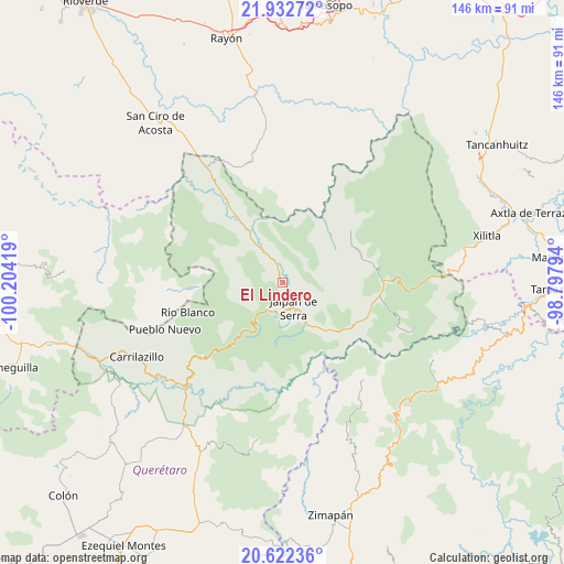
El Lindero GPS coordinates[2]
21° 16' 44.4" North, 99° 30' 3.816" West
| Map corner | latitude | longitude |
|---|---|---|
| Upper-left | 21.93272°, | -100.20419° |
| Center: | 21.279°, | -99.50106° |
| Lower-right: | 20.62236°, | -98.79794° |
| Map W x H: | 145.7×145.7 km | = 90.5×90.5mi |
| max Lat: | 32.7° ⇑20.2% North |
| El Lindero: | 21.279° |
| min Lat: | ⇓79.8% South 14.53588° |
| min Long | El Lindero | max Long |
| -117.105° | -99.50106° | -86.73105° |
| W 43%⇐ | ⇒57% E |
Elevation
Elevation of El Lindero is 768 m = 2520 ft, and this is 485.7 m = 1594 ft below average elevation for this country.
| Max E: |
3497 m = 11473 ft | 63.7% |
| Avg. | 1253.7 m = 4113 ft | |
| El Lindero | 768 m = 2520 ft | |
Min E: |
-1 m = -3 ft | 36.3% |
See also: Mexico elevation on elevation.city.
Geographical zone
El Lindero is located in North Torrid zone (between Equator and Tropic of Cancer). Distance of this Northern Tropic circle is 239.9 km =149.1 mi to North.| Distance of | km | miles | from El Lindero |
|---|---|---|---|
| North Pole | 7641.1 | 4748 | to North |
| Arctic Circle | 5035.2 | 3128.7 | to North |
| Tropic Cancer | 239.9 | 149.1 | to North |
| Equator | 2366 | 1470.2 | to South |


Nearby cities:
15 places around El Lindero: (largest is in red/bold)
• Ahuacatlán de Guadalupe
8.2 km =5.1 mi,  209°
209°
• Atarjea
22.6 km =14 mi,  266°
266°
• Camargo
30.9 km =19.2 mi,  231°
231°
• Concá
23.1 km =14.4 mi,  322°
322°
• Encino Solo
24.5 km =15.2 mi,  96°
96°
• Jalpan
7.4 km =4.6 mi,  155°
155°
• La Lagunita
25.3 km =15.7 mi, 98°
• La Parada
26.7 km =16.6 mi,  8°
8°
• La Vuelta
27 km =16.8 mi,  88°
88°
• Landa de Matamoros
21.5 km =13.4 mi,  119°
119°
• Pinal de Amoles
20.6 km =12.8 mi,  218°
218°
• Purísima de Arista
3.7 km =2.3 mi,  342°
342°
• San Diego (Pueblo Viejo)
24.3 km =15.1 mi,  3°
3°
• Santa María Acapulco
22.3 km =13.9 mi,  16°
16°
• Sauz de Guadalupe
12.2 km =7.6 mi,  247°
247°
Sources, notices
• [Note1] Compared only with cities in Mexico existing in our database
• [Src1] Map data: © OpenStreetMap contributors (CC-BY-SA)
• [Src2] Other city data from geonames.org with taken over terms of usage.
• [Src3] Geographical zone / Annual Mean Temperature by Robert A. Rohde @ Wikipedia
