San Pedro Xochicuaco geodata
San Pedro Xochicuaco (Hidalgo) is a populated place; located in Mexico in America/Mexico_City (GMT-6) time zone. With population of 569 people, there are 15027 cities with bigger population in this country. Compared to other cities in Mexico, 79.4% of cities are located further ↓South; 50.3% of cities are located further ←West and 59.6% of cities have higher elevation than San Pedro Xochicuaco. Note1


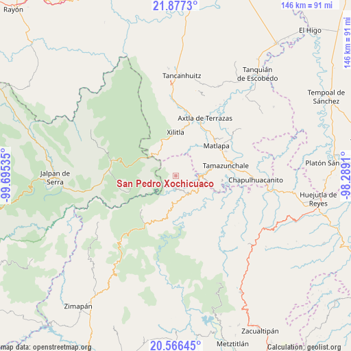
San Pedro Xochicuaco GPS coordinates[2]
21° 13' 23.988" North, 98° 59' 31.992" West
| Map corner | latitude | longitude |
|---|---|---|
| Upper-left | 21.8773°, | -99.69535° |
| Center: | 21.22333°, | -98.99222° |
| Lower-right: | 20.56645°, | -98.2891° |
| Map W x H: | 145.8×145.8 km | = 90.6×90.6mi |
| max Lat: | 32.7° ⇑20.6% North |
| San Pedro Xochicuaco: | 21.22333° |
| min Lat: | ⇓79.4% South 14.53588° |
| min Long | San Pedro Xochi | max Long |
| -117.105° | -98.99222° | -86.73105° |
| W 50.3%⇐ | ⇒49.7% E |
Elevation
Elevation of San Pedro Xochicuaco is 1020 m = 3346 ft, and this is 233.7 m = 767 ft below average elevation for this country.
| Max E: |
3497 m = 11473 ft | 59.6% |
| Avg. | 1253.7 m = 4113 ft | |
| San Pedro Xochicuaco | 1020 m = 3346 ft | |
Min E: |
-1 m = -3 ft | 40.4% |
See also: Mexico elevation on elevation.city.
Geographical zone
San Pedro Xochicuaco is located in North Torrid zone (between Equator and Tropic of Cancer). Distance of this Northern Tropic circle is 246.1 km =152.9 mi to North.| Distance of | km | miles | from San Pedro Xochicuaco |
|---|---|---|---|
| North Pole | 7647.2 | 4751.7 | to North |
| Arctic Circle | 5041.4 | 3132.6 | to North |
| Tropic Cancer | 246.1 | 152.9 | to North |
| Equator | 2359.8 | 1466.3 | to South |


Nearby cities:
15 places around San Pedro Xochicuaco: (largest is in red/bold)
• Agua Zarca
10.2 km =6.3 mi,  267°
267°
• Barrio de Guadalupe
11.3 km =7 mi,  84°
84°
• El Chalahuite
5.3 km =3.3 mi,  70°
70°
• El Rayo
3.2 km =2 mi,  293°
293°
• Gargantilla
5.9 km =3.7 mi,  37°
37°
• La Ameca
7 km =4.3 mi, 66°
• La Arena
7 km =4.3 mi, 38°
• La Loma
8.6 km =5.3 mi,  121°
121°
• Las Moras
8.6 km =5.3 mi,  33°
33°
• Neblinas
8.6 km =5.3 mi,  308°
308°
• Pisaflores
3.5 km =2.2 mi,  203°
203°
• Sabino
10.9 km =6.8 mi,  12°
12°
• Santa Ana de Allende
11.2 km =7 mi,  176°
176°
• Santa María de Álamos
10 km =6.2 mi,  166°
166°
• Tamán
11.7 km =7.3 mi,  85°
85°
Sources, notices
• [Note1] Compared only with cities in Mexico existing in our database
• [Src1] Map data: © OpenStreetMap contributors (CC-BY-SA)
• [Src2] Other city data from geonames.org with taken over terms of usage.
• [Src3] Geographical zone / Annual Mean Temperature by Robert A. Rohde @ Wikipedia
