La Arena geodata
La Arena (Hidalgo) is a populated place; located in Mexico in America/Mexico_City (GMT-6) time zone. With population of 677 people, there are 12831 cities with bigger population in this country. Compared to other cities in Mexico, 79.8% of cities are located further ↓South; 51% of cities are located further ←West and 65% of cities have higher elevation than La Arena. Note1


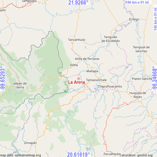
La Arena GPS coordinates[2]
21° 16' 22.26" North, 98° 56' 59.28" West
| Map corner | latitude | longitude |
|---|---|---|
| Upper-left | 21.9266°, | -99.65293° |
| Center: | 21.27285°, | -98.9498° |
| Lower-right: | 20.61619°, | -98.24668° |
| Map W x H: | 145.7×145.7 km | = 90.5×90.5mi |
| max Lat: | 32.7° ⇑20.2% North |
| La Arena: | 21.27285° |
| min Lat: | ⇓79.8% South 14.53588° |
| min Long | La Arena | max Long |
| -117.105° | -98.9498° | -86.73105° |
| W 51%⇐ | ⇒49% E |
Elevation
Elevation of La Arena is 688 m = 2257 ft, and this is 565.7 m = 1856 ft below average elevation for this country.
| Max E: |
3497 m = 11473 ft | 65% |
| Avg. | 1253.7 m = 4113 ft | |
| La Arena | 688 m = 2257 ft | |
Min E: |
-1 m = -3 ft | 35% |
See also: Mexico elevation on elevation.city.
Geographical zone
La Arena is located in North Torrid zone (between Equator and Tropic of Cancer). Distance of this Northern Tropic circle is 240.6 km =149.5 mi to North.| Distance of | km | miles | from La Arena |
|---|---|---|---|
| North Pole | 7641.7 | 4748.3 | to North |
| Arctic Circle | 5035.9 | 3129.2 | to North |
| Tropic Cancer | 240.6 | 149.5 | to North |
| Equator | 2365.3 | 1469.7 | to South |


Nearby cities:
15 places around La Arena: (largest is in red/bold)
• Barrio de Guadalupe
8.2 km =5.1 mi,  123°
123°
• Coaquentla
7.1 km =4.4 mi,  52°
52°
• El Chalahuite
3.8 km =2.4 mi,  171°
171°
• El Rayo
8.5 km =5.3 mi,  239°
239°
• Gargantilla
1.2 km =0.7 mi,  224°
224°
• La Ameca
3.4 km =2.1 mi,  143°
143°
• Las Moras
1.7 km =1.1 mi,  12°
12°
• Pahuayo Primero
7.7 km =4.8 mi, 47°
• Pilateno
6.8 km =4.2 mi,  342°
342°
• Sabino
5.5 km =3.4 mi, 338°
• San Francisco
6.2 km =3.9 mi,  83°
83°
• San Pedro Xochicuaco
7 km =4.3 mi, 218°
• Tamán
8.6 km =5.3 mi, 121°
• Tlacohuaque
8.3 km =5.2 mi,  31°
31°
• Zacayo
6.3 km =3.9 mi,  37°
37°
Sources, notices
• [Note1] Compared only with cities in Mexico existing in our database
• [Src1] Map data: © OpenStreetMap contributors (CC-BY-SA)
• [Src2] Other city data from geonames.org with taken over terms of usage.
• [Src3] Geographical zone / Annual Mean Temperature by Robert A. Rohde @ Wikipedia
