Emiliano Zapata geodata
Emiliano Zapata (Michoacán) is a populated place; located in Mexico in America/Mexico_City (GMT-6) time zone. With population of 563 people, there are 15167 cities with bigger population in this country. Compared to other cities in Mexico, 54.6% of cities are located further ↓South; 74% of cities are located further →East and 65.5% of cities have lower elevation than Emiliano Zapata. Note1


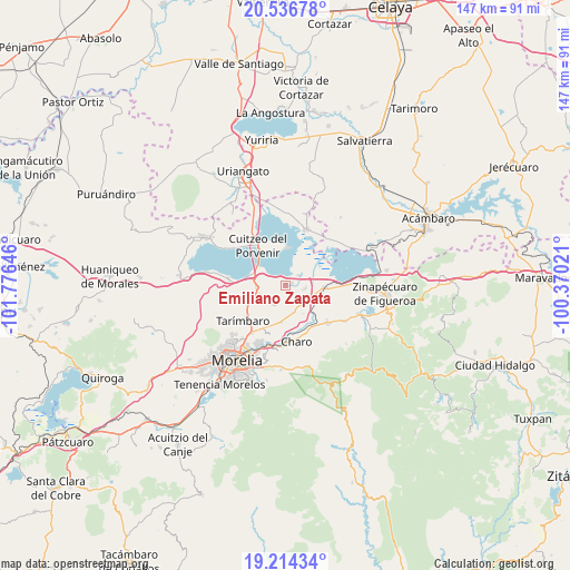
Emiliano Zapata GPS coordinates[2]
19° 52' 36.984" North, 101° 4' 23.988" West
| Map corner | latitude | longitude |
|---|---|---|
| Upper-left | 20.53678°, | -101.77646° |
| Center: | 19.87694°, | -101.07333° |
| Lower-right: | 19.21434°, | -100.37021° |
| Map W x H: | 147×147 km | = 91.3×91.3mi |
| max Lat: | 32.7° ⇑45.4% North |
| Emiliano Zapata: | 19.87694° |
| min Lat: | ⇓54.6% South 14.53588° |
| min Long | Emiliano Zapata | max Long |
| -117.105° | -101.07333° | -86.73105° |
| W 26%⇐ | ⇒74% E |
Elevation
Elevation of Emiliano Zapata is 1842 m = 6043 ft, and this is 588.3 m = 1930 ft above average elevation for this country.
| Max E: |
3497 m = 11473 ft | 34.5% |
| Emiliano Zapata | 1842 m 6043 ft | |
| Avg. | 1253.7 m = 4113 ft | |
Min E: |
-1 m = -3 ft | 65.5% |
See also: Mexico elevation on elevation.city.
Geographical zone
Emiliano Zapata is located in North Torrid zone (between Equator and Tropic of Cancer). Distance of this Northern Tropic circle is 395.8 km =245.9 mi to North.| Distance of | km | miles | from Emiliano Zapata |
|---|---|---|---|
| North Pole | 7797 | 4844.8 | to North |
| Arctic Circle | 5191.1 | 3225.6 | to North |
| Tropic Cancer | 395.8 | 245.9 | to North |
| Equator | 2210.1 | 1373.3 | to South |


Nearby cities:
15 places around Emiliano Zapata: (largest is in red/bold)
• Chehuayo Grande
2.3 km =1.4 mi,  15°
15°
• Cuparátaro
3.3 km =2.1 mi,  209°
209°
• Cuto del Porvenir
7.4 km =4.6 mi,  263°
263°
• El Calvario
8.7 km =5.4 mi,  168°
168°
• Felipe Carrillo Puerto
4.4 km =2.7 mi,  56°
56°
• Jamaica
6.9 km =4.3 mi,  249°
249°
• La Mina
9.7 km =6 mi,  77°
77°
• La Noria
6.1 km =3.8 mi,  229°
229°
• La Presa
4.6 km =2.9 mi,  54°
54°
• Las Trojes
1.9 km =1.2 mi,  66°
66°
• Lázaro Cárdenas (La Purísima)
5.3 km =3.3 mi,  98°
98°
• San Agustín del Pulque
9.5 km =5.9 mi,  0°
0°
• San Juan Benito Juárez (San Juan Tararameo)
7.3 km =4.5 mi,  307°
307°
• Santa Cruz
9.1 km =5.7 mi, 253°
• Álvaro Obregón
7.1 km =4.4 mi,  150°
150°
Sources, notices
• [Note1] Compared only with cities in Mexico existing in our database
• [Src1] Map data: © OpenStreetMap contributors (CC-BY-SA)
• [Src2] Other city data from geonames.org with taken over terms of usage.
• [Src3] Geographical zone / Annual Mean Temperature by Robert A. Rohde @ Wikipedia
