Lomas de Comanjilla geodata
Lomas de Comanjilla (Guanajuato) is a populated place; located in Mexico in America/Mexico_City (GMT-6) time zone. With population of 560 people, there are 15231 cities with bigger population in this country. Compared to other cities in Mexico, 76.9% of cities are located further ↓South; 77.7% of cities are located further →East and 65.6% of cities have lower elevation than Lomas de Comanjilla. Note1


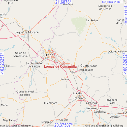
Lomas de Comanjilla GPS coordinates[2]
21° 1' 58.008" North, 101° 31' 45.984" West
| Map corner | latitude | longitude |
|---|---|---|
| Upper-left | 21.6876°, | -102.23257° |
| Center: | 21.03278°, | -101.52944° |
| Lower-right: | 20.37507°, | -100.82632° |
| Map W x H: | 145.9×145.9 km | = 90.7×90.7mi |
| max Lat: | 32.7° ⇑23.1% North |
| Lomas de Comanjilla: | 21.03278° |
| min Lat: | ⇓76.9% South 14.53588° |
| min Long | Lomas de Comanj | max Long |
| -117.105° | -101.52944° | -86.73105° |
| W 22.3%⇐ | ⇒77.7% E |
Elevation
Elevation of Lomas de Comanjilla is 1843 m = 6047 ft, and this is 589.3 m = 1933 ft above average elevation for this country.
| Max E: |
3497 m = 11473 ft | 34.4% |
| Lomas de Comanjilla | 1843 m 6047 ft | |
| Avg. | 1253.7 m = 4113 ft | |
Min E: |
-1 m = -3 ft | 65.6% |
See also: Mexico elevation on elevation.city.
Geographical zone
Lomas de Comanjilla is located in North Torrid zone (between Equator and Tropic of Cancer). Distance of this Northern Tropic circle is 267.3 km =166.1 mi to North.| Distance of | km | miles | from Lomas de Comanjilla |
|---|---|---|---|
| North Pole | 7668.4 | 4764.9 | to North |
| Arctic Circle | 5062.5 | 3145.7 | to North |
| Tropic Cancer | 267.3 | 166.1 | to North |
| Equator | 2338.6 | 1453.1 | to South |


Nearby cities:
15 places around Lomas de Comanjilla: (largest is in red/bold)
• Albarradones
2.8 km =1.7 mi,  72°
72°
• Arboledas de los López Primera Sección
5.8 km =3.6 mi,  284°
284°
• Comanjilla
6.9 km =4.3 mi,  58°
58°
• Duarte
6.1 km =3.8 mi,  5°
5°
• El Refugio de los Sauces
2 km =1.2 mi,  184°
184°
• Guadalupe Victoria
5.4 km =3.4 mi,  253°
253°
• La Esperanza del Refugio
2.5 km =1.6 mi,  159°
159°
• Ladrilleras del Refugio
6.3 km =3.9 mi,  336°
336°
• Lomas de la Loza
4.2 km =2.6 mi,  322°
322°
• Loza de Barrera
5.4 km =3.4 mi, 180°
• Loza de los Padres
4.7 km =2.9 mi, 338°
• Mezquite de Sotelo
3.9 km =2.4 mi,  134°
134°
• San Antonio Texas
6.7 km =4.2 mi,  142°
142°
• San Isidro de los Sauces
1.5 km =0.9 mi,  211°
211°
• San Miguel del Arenal
6.5 km =4 mi, 135°
Sources, notices
• [Note1] Compared only with cities in Mexico existing in our database
• [Src1] Map data: © OpenStreetMap contributors (CC-BY-SA)
• [Src2] Other city data from geonames.org with taken over terms of usage.
• [Src3] Geographical zone / Annual Mean Temperature by Robert A. Rohde @ Wikipedia
