Empleado Municipal geodata
Empleado Municipal (Morelos) is a populated place; located in Mexico in America/Mexico_City (GMT-6) time zone. With population of 557 people, there are 15314 cities with bigger population in this country. Compared to other cities in Mexico, 68.9% of cities are located further ↑North; 51.8% of cities are located further ←West and 51.4% of cities have higher elevation than Empleado Municipal. Note1


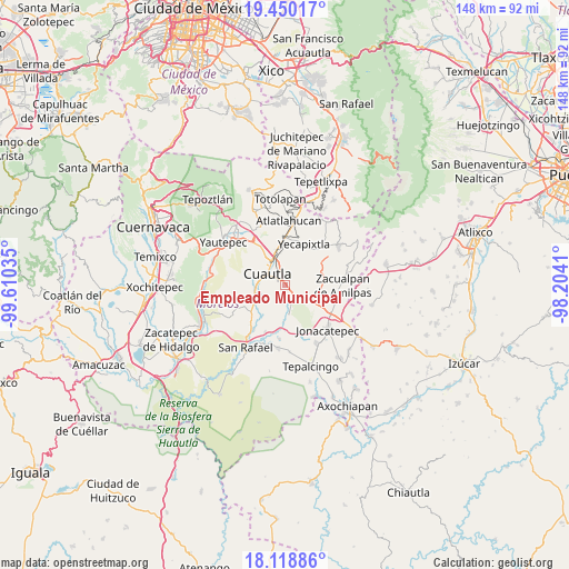
Empleado Municipal GPS coordinates[2]
18° 47' 8.988" North, 98° 54' 25.992" West
| Map corner | latitude | longitude |
|---|---|---|
| Upper-left | 19.45017°, | -99.61035° |
| Center: | 18.78583°, | -98.90722° |
| Lower-right: | 18.11886°, | -98.2041° |
| Map W x H: | 148×148 km | = 92×92mi |
| max Lat: | 32.7° ⇑68.9% North |
| Empleado Municipal: | 18.78583° |
| min Lat: | ⇓31.1% South 14.53588° |
| min Long | Empleado Munici | max Long |
| -117.105° | -98.90722° | -86.73105° |
| W 51.8%⇐ | ⇒48.2% E |
Elevation
Elevation of Empleado Municipal is 1362 m = 4469 ft, and this is 108.3 m = 355 ft above average elevation for this country.
| Max E: |
3497 m = 11473 ft | 51.4% |
| Empleado Municipal | 1362 m 4469 ft | |
| Avg. | 1253.7 m = 4113 ft | |
Min E: |
-1 m = -3 ft | 48.6% |
See also: Mexico elevation on elevation.city.
Geographical zone
Empleado Municipal is located in North Torrid zone (between Equator and Tropic of Cancer). Distance of this Northern Tropic circle is 517.1 km =321.3 mi to North.| Distance of | km | miles | from Empleado Municipal |
|---|---|---|---|
| North Pole | 7918.3 | 4920.2 | to North |
| Arctic Circle | 5312.4 | 3301 | to North |
| Tropic Cancer | 517.1 | 321.3 | to North |
| Equator | 2088.8 | 1297.9 | to South |


Nearby cities:
15 places around Empleado Municipal: (largest is in red/bold)
• Colonia las Arboledas
3.4 km =2.1 mi,  268°
268°
• Constancio Farfán (La Pascuala)
6.9 km =4.3 mi,  225°
225°
• Cuautla
4 km =2.5 mi,  313°
313°
• Fraccionamiento Huertas de Cuautla
2.4 km =1.5 mi,  193°
193°
• Fraccionamiento las Llaves
6.6 km =4.1 mi,  114°
114°
• Huexca
4.5 km =2.8 mi,  62°
62°
• Juan Morales
3.2 km =2 mi,  331°
331°
• Loma Bonita
3.2 km =2 mi,  343°
343°
• Los Limones
6.8 km =4.2 mi,  87°
87°
• Mixtlalcingo
2.1 km =1.3 mi,  20°
20°
• Niños Héroes
5.6 km =3.5 mi,  245°
245°
• Reforma
2.9 km =1.8 mi,  261°
261°
• San Pedro Apatlaco
5.6 km =3.5 mi,  278°
278°
• Unidad Habitacional 10 de Abril
3.6 km =2.2 mi,  195°
195°
• Xalostoc
7.1 km =4.4 mi,  172°
172°
Sources, notices
• [Note1] Compared only with cities in Mexico existing in our database
• [Src1] Map data: © OpenStreetMap contributors (CC-BY-SA)
• [Src2] Other city data from geonames.org with taken over terms of usage.
• [Src3] Geographical zone / Annual Mean Temperature by Robert A. Rohde @ Wikipedia
