Coaxinquila geodata
Coaxinquila (San Luis Potosí) is a populated place; located in Mexico in America/Mexico_City (GMT-6) time zone. With population of 547 people, there are 15556 cities with bigger population in this country. Compared to other cities in Mexico, 81.7% of cities are located further ↓South; 52.6% of cities are located further ←West and 79.5% of cities have higher elevation than Coaxinquila. Note1


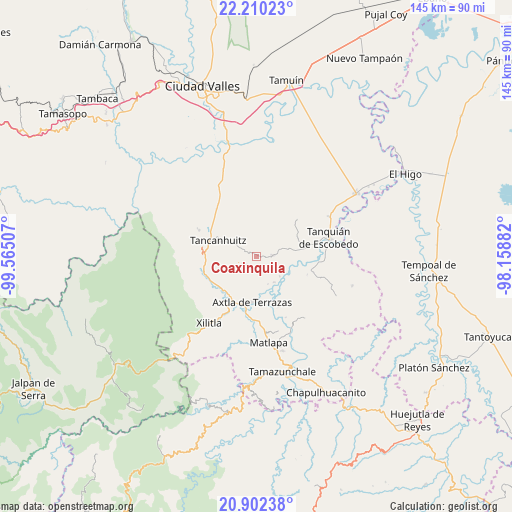
Coaxinquila GPS coordinates[2]
21° 33' 28.008" North, 98° 51' 42.984" West
| Map corner | latitude | longitude |
|---|---|---|
| Upper-left | 22.21023°, | -99.56507° |
| Center: | 21.55778°, | -98.86194° |
| Lower-right: | 20.90238°, | -98.15882° |
| Map W x H: | 145.4×145.4 km | = 90.3×90.3mi |
| max Lat: | 32.7° ⇑18.3% North |
| Coaxinquila: | 21.55778° |
| min Lat: | ⇓81.7% South 14.53588° |
| min Long | Coaxinquila | max Long |
| -117.105° | -98.86194° | -86.73105° |
| W 52.6%⇐ | ⇒47.4% E |
Elevation
Elevation of Coaxinquila is 103 m = 338 ft, and this is 1150.7 m = 3775 ft below average elevation for this country.
| Max E: |
3497 m = 11473 ft | 79.5% |
| Avg. | 1253.7 m = 4113 ft | |
| Coaxinquila | 103 m = 338 ft | |
Min E: |
-1 m = -3 ft | 20.5% |
See also: Mexico elevation on elevation.city.
Geographical zone
Coaxinquila is located in North Torrid zone (between Equator and Tropic of Cancer). Distance of this Northern Tropic circle is 208.9 km =129.8 mi to North.| Distance of | km | miles | from Coaxinquila |
|---|---|---|---|
| North Pole | 7610.1 | 4728.7 | to North |
| Arctic Circle | 5004.2 | 3109.5 | to North |
| Tropic Cancer | 208.9 | 129.8 | to North |
| Equator | 2397 | 1489.4 | to South |


Nearby cities:
15 places around Coaxinquila: (largest is in red/bold)
• Ajuatitla Primera Sección
6.6 km =4.1 mi,  224°
224°
• Amaxac
7.6 km =4.7 mi,  209°
209°
• Comunidad Calmecayo
4 km =2.5 mi,  197°
197°
• Coxcatlán
5 km =3.1 mi,  248°
248°
• Las Mesas
3.5 km =2.2 mi,  166°
166°
• Lejem
5.8 km =3.6 mi,  355°
355°
• San Antonio
8.2 km =5.1 mi,  328°
328°
• Tampamolón Corona
4.5 km =2.8 mi,  88°
88°
• Tampochocho
7.7 km =4.8 mi,  186°
186°
• Tampuchón
10.7 km =6.6 mi,  240°
240°
• Tan Jajnec
9.2 km =5.7 mi,  338°
338°
• Tanleab Uno
10 km =6.2 mi,  260°
260°
• Tocoy
9 km =5.6 mi,  354°
354°
• Tonatico
9 km =5.6 mi,  145°
145°
• Xoloco
10.5 km =6.5 mi, 199°
Sources, notices
• [Note1] Compared only with cities in Mexico existing in our database
• [Src1] Map data: © OpenStreetMap contributors (CC-BY-SA)
• [Src2] Other city data from geonames.org with taken over terms of usage.
• [Src3] Geographical zone / Annual Mean Temperature by Robert A. Rohde @ Wikipedia
