San Antonio geodata
San Antonio (San Luis Potosí) is a seat of a second-order administrative division; located in Mexico in America/Mexico_City (GMT-6) time zone. With population of 643 people, there are 13457 cities with bigger population in this country. Compared to other cities in Mexico, 82% of cities are located further ↓South; 51.9% of cities are located further ←West and 75% of cities have higher elevation than San Antonio. Note1


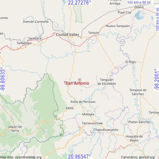
San Antonio GPS coordinates[2]
21° 37' 14.124" North, 98° 54' 11.592" West
| Map corner | latitude | longitude |
|---|---|---|
| Upper-left | 22.27276°, | -99.60635° |
| Center: | 21.62059°, | -98.90322° |
| Lower-right: | 20.96547°, | -98.2001° |
| Map W x H: | 145.4×145.4 km | = 90.3×90.3mi |
| max Lat: | 32.7° ⇑18% North |
| San Antonio: | 21.62059° |
| min Lat: | ⇓82% South 14.53588° |
| min Long | San Antonio | max Long |
| -117.105° | -98.90322° | -86.73105° |
| W 51.9%⇐ | ⇒48.1% E |
Elevation
Elevation of San Antonio is 221 m = 725 ft, and this is 1032.7 m = 3388 ft below average elevation for this country.
| Max E: |
3497 m = 11473 ft | 75% |
| Avg. | 1253.7 m = 4113 ft | |
| San Antonio | 221 m = 725 ft | |
Min E: |
-1 m = -3 ft | 25% |
See also: Mexico elevation on elevation.city.
Geographical zone
San Antonio is located in North Torrid zone (between Equator and Tropic of Cancer). Distance of this Northern Tropic circle is 201.9 km =125.5 mi to North.| Distance of | km | miles | from San Antonio |
|---|---|---|---|
| North Pole | 7603.1 | 4724.3 | to North |
| Arctic Circle | 4997.2 | 3105.1 | to North |
| Tropic Cancer | 201.9 | 125.5 | to North |
| Equator | 2404 | 1493.8 | to South |


Nearby cities:
15 places around San Antonio: (largest is in red/bold)
• Coaxinquila
8.2 km =5.1 mi,  148°
148°
• Coromohom (Tocoymohom)
6.5 km =4 mi,  12°
12°
• Coxcatlán
8.9 km =5.5 mi,  182°
182°
• Ejido San José Xilatzén
6.5 km =4 mi,  337°
337°
• Ejido el Barrancón
7.3 km =4.5 mi,  37°
37°
• Lejem
4 km =2.5 mi,  108°
108°
• Nuevo Cueytzén
8.9 km =5.5 mi,  20°
20°
• San José Pequetzén
5.9 km =3.7 mi,  279°
279°
• Tan Jajnec
1.8 km =1.1 mi,  29°
29°
• Tancanhuitz
7.1 km =4.4 mi,  249°
249°
• Tandzumadz
10.1 km =6.3 mi,  232°
232°
• Tanlajás
5.3 km =3.3 mi, 19°
• Tanleab Uno
10.3 km =6.4 mi,  212°
212°
• Tocoy
3.9 km =2.4 mi,  59°
59°
• Tzinejá Uno
8.9 km =5.5 mi, 227°
Sources, notices
• [Note1] Compared only with cities in Mexico existing in our database
• [Src1] Map data: © OpenStreetMap contributors (CC-BY-SA)
• [Src2] Other city data from geonames.org with taken over terms of usage.
• [Src3] Geographical zone / Annual Mean Temperature by Robert A. Rohde @ Wikipedia
