Tan Jajnec geodata
Tan Jajnec (San Luis Potosí) is a populated place; located in Mexico in America/Mexico_City (GMT-6) time zone. With population of 564 people, there are 15153 cities with bigger population in this country. Compared to other cities in Mexico, 82.1% of cities are located further ↓South; 52.1% of cities are located further ←West and 73.5% of cities have higher elevation than Tan Jajnec. Note1


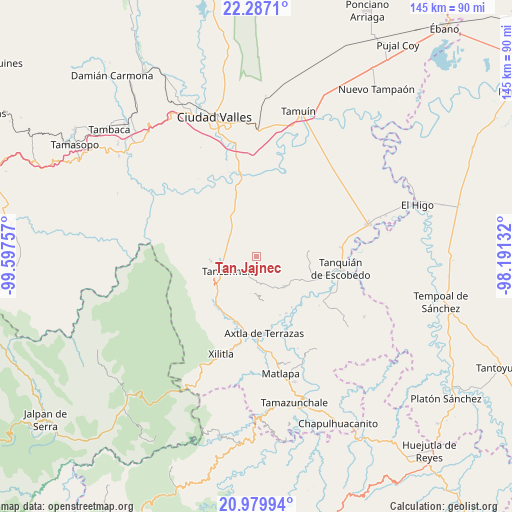
Tan Jajnec GPS coordinates[2]
21° 38' 6" North, 98° 53' 39.984" West
| Map corner | latitude | longitude |
|---|---|---|
| Upper-left | 22.2871°, | -99.59757° |
| Center: | 21.635°, | -98.89444° |
| Lower-right: | 20.97994°, | -98.19132° |
| Map W x H: | 145.3×145.3 km | = 90.3×90.3mi |
| max Lat: | 32.7° ⇑17.9% North |
| Tan Jajnec: | 21.635° |
| min Lat: | ⇓82.1% South 14.53588° |
| min Long | Tan Jajnec | max Long |
| -117.105° | -98.89444° | -86.73105° |
| W 52.1%⇐ | ⇒47.9% E |
Elevation
Elevation of Tan Jajnec is 273 m = 896 ft, and this is 980.7 m = 3218 ft below average elevation for this country.
| Max E: |
3497 m = 11473 ft | 73.5% |
| Avg. | 1253.7 m = 4113 ft | |
| Tan Jajnec | 273 m = 896 ft | |
Min E: |
-1 m = -3 ft | 26.5% |
See also: Mexico elevation on elevation.city.
Geographical zone
Tan Jajnec is located in North Torrid zone (between Equator and Tropic of Cancer). Distance of this Northern Tropic circle is 200.3 km =124.5 mi to North.| Distance of | km | miles | from Tan Jajnec |
|---|---|---|---|
| North Pole | 7601.5 | 4723.4 | to North |
| Arctic Circle | 4995.6 | 3104.1 | to North |
| Tropic Cancer | 200.3 | 124.5 | to North |
| Equator | 2405.6 | 1494.8 | to South |


Nearby cities:
15 places around Tan Jajnec: (largest is in red/bold)
• Coaxinquila
9.2 km =5.7 mi,  158°
158°
• Coromohom (Tocoymohom)
4.8 km =3 mi,  5°
5°
• Coxcatlán
10.5 km =6.5 mi,  187°
187°
• Ejido San José Xilatzén
5.6 km =3.5 mi,  322°
322°
• Ejido el Barrancón
5.4 km =3.4 mi,  40°
40°
• El Fortín May
9.3 km =5.8 mi, 37°
• Las Armas
10.2 km =6.3 mi,  312°
312°
• Lejem
4.1 km =2.5 mi,  134°
134°
• Nuevo Cueytzén
7.1 km =4.4 mi,  18°
18°
• San Antonio
1.8 km =1.1 mi,  209°
209°
• San José Pequetzén
6.7 km =4.2 mi,  264°
264°
• Tancanhuitz
8.6 km =5.3 mi,  241°
241°
• Tanlajás
3.5 km =2.2 mi, 14°
• Tocoy
2.5 km =1.6 mi,  80°
80°
• Tzinejá Uno
10.7 km =6.6 mi,  224°
224°
Sources, notices
• [Note1] Compared only with cities in Mexico existing in our database
• [Src1] Map data: © OpenStreetMap contributors (CC-BY-SA)
• [Src2] Other city data from geonames.org with taken over terms of usage.
• [Src3] Geographical zone / Annual Mean Temperature by Robert A. Rohde @ Wikipedia
