Huehuetepec geodata
Huehuetepec (Guerrero) is a populated place; located in Mexico in America/Mexico_City (GMT-6) time zone. With population of 539 people, there are 15751 cities with bigger population in this country. Compared to other cities in Mexico, 85.7% of cities are located further ↑North; 56.2% of cities are located further ←West and 87.6% of cities have lower elevation than Huehuetepec. Note1


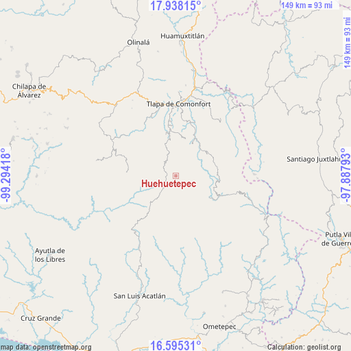
Huehuetepec GPS coordinates[2]
17° 16' 4.62" North, 98° 35' 27.78" West
| Map corner | latitude | longitude |
|---|---|---|
| Upper-left | 17.93815°, | -99.29418° |
| Center: | 17.26795°, | -98.59105° |
| Lower-right: | 16.59531°, | -97.88793° |
| Map W x H: | 149.3×149.3 km | = 92.8×92.8mi |
| max Lat: | 32.7° ⇑85.7% North |
| Huehuetepec: | 17.26795° |
| min Lat: | ⇓14.3% South 14.53588° |
| min Long | Huehuetepec | max Long |
| -117.105° | -98.59105° | -86.73105° |
| W 56.2%⇐ | ⇒43.8% E |
Elevation
Elevation of Huehuetepec is 2329 m = 7641 ft, and this is 1075.3 m = 3528 ft above average elevation for this country.
| Max E: |
3497 m = 11473 ft | 12.4% |
| Huehuetepec | 2329 m 7641 ft | |
| Avg. | 1253.7 m = 4113 ft | |
Min E: |
-1 m = -3 ft | 87.6% |
See also: Mexico elevation on elevation.city.
Geographical zone
Huehuetepec is located in North Torrid zone (between Equator and Tropic of Cancer). Distance of this Northern Tropic circle is 685.9 km =426.2 mi to North.| Distance of | km | miles | from Huehuetepec |
|---|---|---|---|
| North Pole | 8087 | 5025 | to North |
| Arctic Circle | 5481.2 | 3405.9 | to North |
| Tropic Cancer | 685.9 | 426.2 | to North |
| Equator | 1920 | 1193 | to South |


Nearby cities:
15 places around Huehuetepec: (largest is in red/bold)
• Atlamajalcingo del Monte
5 km =3.1 mi,  344°
344°
• Cuatzoquitengo
3.4 km =2.1 mi,  311°
311°
• El Tejocote
9.9 km =6.2 mi, 313°
• Francisco I. Madero
9.7 km =6 mi,  63°
63°
• Juanacatlán
10.7 km =6.6 mi,  51°
51°
• Malinaltepec
8.9 km =5.5 mi,  253°
253°
• Mixtecapa
5.2 km =3.2 mi,  227°
227°
• Moyotepec (Moyotepec de Juárez)
12.3 km =7.6 mi, 305°
• Ojo de Agua de Cuauhtémoc
10.1 km =6.3 mi,  223°
223°
• San Juan Puerto Montaña
7.6 km =4.7 mi,  80°
80°
• Santa Cruz
7.9 km =4.9 mi, 45°
• Santa María Tonaya
13.7 km =8.5 mi,  35°
35°
• Tepecocatlán
6.8 km =4.2 mi, 335°
• Tierra Blanca
13 km =8.1 mi,  88°
88°
• Zilacayotitlán
5.3 km =3.3 mi, 55°
Sources, notices
• [Note1] Compared only with cities in Mexico existing in our database
• [Src1] Map data: © OpenStreetMap contributors (CC-BY-SA)
• [Src2] Other city data from geonames.org with taken over terms of usage.
• [Src3] Geographical zone / Annual Mean Temperature by Robert A. Rohde @ Wikipedia
