Santa Cruz geodata
Santa Cruz (Guerrero) is a populated place; located in Mexico in America/Mexico_City (GMT-6) time zone. With population of 510 people, there are 16480 cities with bigger population in this country. Compared to other cities in Mexico, 85.1% of cities are located further ↑North; 56.8% of cities are located further ←West and 84.6% of cities have lower elevation than Santa Cruz. Note1


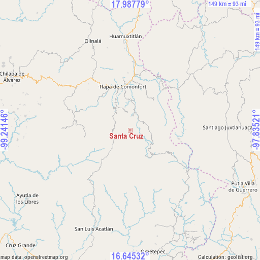
Santa Cruz GPS coordinates[2]
17° 19' 4.008" North, 98° 32' 17.988" West
| Map corner | latitude | longitude |
|---|---|---|
| Upper-left | 17.98779°, | -99.24146° |
| Center: | 17.31778°, | -98.53833° |
| Lower-right: | 16.64532°, | -97.83521° |
| Map W x H: | 149.3×149.3 km | = 92.8×92.8mi |
| max Lat: | 32.7° ⇑85.1% North |
| Santa Cruz: | 17.31778° |
| min Lat: | ⇓14.9% South 14.53588° |
| min Long | Santa Cruz | max Long |
| -117.105° | -98.53833° | -86.73105° |
| W 56.8%⇐ | ⇒43.2% E |
Elevation
Elevation of Santa Cruz is 2253 m = 7392 ft, and this is 999.3 m = 3279 ft above average elevation for this country.
| Max E: |
3497 m = 11473 ft | 15.4% |
| Santa Cruz | 2253 m 7392 ft | |
| Avg. | 1253.7 m = 4113 ft | |
Min E: |
-1 m = -3 ft | 84.6% |
See also: Mexico elevation on elevation.city.
Geographical zone
Santa Cruz is located in North Torrid zone (between Equator and Tropic of Cancer). Distance of this Northern Tropic circle is 680.4 km =422.8 mi to North.| Distance of | km | miles | from Santa Cruz |
|---|---|---|---|
| North Pole | 8081.5 | 5021.6 | to North |
| Arctic Circle | 5475.6 | 3402.4 | to North |
| Tropic Cancer | 680.4 | 422.8 | to North |
| Equator | 1925.6 | 1196.5 | to South |


Nearby cities:
15 places around Santa Cruz: (largest is in red/bold)
• Atlamajalcingo del Monte
7 km =4.3 mi,  264°
264°
• Cahuatache
11 km =6.8 mi,  3°
3°
• Cuatzoquitengo
8.8 km =5.5 mi,  248°
248°
• Francisco I. Madero
3.4 km =2.1 mi,  111°
111°
• Huehuetepec
7.9 km =4.9 mi,  225°
225°
• Juanacatlán
3 km =1.9 mi,  68°
68°
• Lomazóyatl (Lomazoya)
9.2 km =5.7 mi,  63°
63°
• Melchor Ocampo
10.7 km =6.6 mi, 64°
• San Juan Puerto Montaña
4.7 km =2.9 mi,  156°
156°
• Santa María Tonaya
6.1 km =3.8 mi,  21°
21°
• Tepecocatlán
8.4 km =5.2 mi,  274°
274°
• Tierra Blanca
9.1 km =5.7 mi,  125°
125°
• Xilotepec (Jilotepec Chiquito)
9.8 km =6.1 mi,  351°
351°
• Xochapa
11.8 km =7.3 mi,  51°
51°
• Zilacayotitlán
2.8 km =1.7 mi,  205°
205°
Sources, notices
• [Note1] Compared only with cities in Mexico existing in our database
• [Src1] Map data: © OpenStreetMap contributors (CC-BY-SA)
• [Src2] Other city data from geonames.org with taken over terms of usage.
• [Src3] Geographical zone / Annual Mean Temperature by Robert A. Rohde @ Wikipedia
