Joljamil geodata
Joljamil (Chiapas) is a populated place; located in Mexico in America/Mexico_City (GMT-6) time zone. With population of 522 people, there are 16162 cities with bigger population in this country. Compared to other cities in Mexico, 85.8% of cities are located further ↑North; 93.2% of cities are located further ←West and 55.7% of cities have higher elevation than Joljamil. Note1


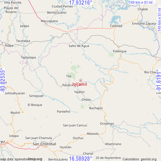
Joljamil GPS coordinates[2]
17° 15' 42.984" North, 92° 19' 19.992" West
| Map corner | latitude | longitude |
|---|---|---|
| Upper-left | 17.93216°, | -93.02535° |
| Center: | 17.26194°, | -92.32222° |
| Lower-right: | 16.58928°, | -91.6191° |
| Map W x H: | 149.3×149.3 km | = 92.8×92.8mi |
| max Lat: | 32.7° ⇑85.8% North |
| Joljamil: | 17.26194° |
| min Lat: | ⇓14.2% South 14.53588° |
| min Long | Joljamil | max Long |
| -117.105° | -92.32222° | -86.73105° |
| W 93.2%⇐ | ⇒6.8% E |
Elevation
Elevation of Joljamil is 1173 m = 3848 ft, and this is 80.7 m = 265 ft below average elevation for this country.
| Max E: |
3497 m = 11473 ft | 55.7% |
| Avg. | 1253.7 m = 4113 ft | |
| Joljamil | 1173 m = 3848 ft | |
Min E: |
-1 m = -3 ft | 44.3% |
See also: Mexico elevation on elevation.city.
Geographical zone
Joljamil is located in North Torrid zone (between Equator and Tropic of Cancer). Distance of this Northern Tropic circle is 686.6 km =426.6 mi to North.| Distance of | km | miles | from Joljamil |
|---|---|---|---|
| North Pole | 8087.7 | 5025.5 | to North |
| Arctic Circle | 5481.8 | 3406.2 | to North |
| Tropic Cancer | 686.6 | 426.6 | to North |
| Equator | 1919.3 | 1192.6 | to South |


Nearby cities:
15 places around Joljamil: (largest is in red/bold)
• Amado Nervo
8.8 km =5.5 mi,  112°
112°
• Benito Juárez
7 km =4.3 mi,  93°
93°
• Cantioc
9 km =5.6 mi,  270°
270°
• Chuchucruz Primera Sección
7.2 km =4.5 mi,  49°
49°
• Emiliano Zapata
9.2 km =5.7 mi,  22°
22°
• Hidalgo Joshil
4.7 km =2.9 mi,  214°
214°
• Joshil
4.6 km =2.9 mi,  248°
248°
• Lázaro Cárdenas
9.5 km =5.9 mi,  221°
221°
• Misija
6.3 km =3.9 mi, 274°
• Pactiún
10 km =6.2 mi, 87°
• Río Grande
10 km =6.2 mi, 271°
• Tocob Leglemal
6.7 km =4.2 mi,  242°
242°
• Tumbala
1.8 km =1.1 mi, 17°
• Unión Juárez
8.5 km =5.3 mi,  284°
284°
• Yajalón
10 km =6.2 mi,  186°
186°
Sources, notices
• [Note1] Compared only with cities in Mexico existing in our database
• [Src1] Map data: © OpenStreetMap contributors (CC-BY-SA)
• [Src2] Other city data from geonames.org with taken over terms of usage.
• [Src3] Geographical zone / Annual Mean Temperature by Robert A. Rohde @ Wikipedia
