Cuaxinca geodata
Cuaxinca (Tlaxcala) is a populated place; located in Mexico in America/Mexico_City (GMT-6) time zone. With population of 514 people, there are 16370 cities with bigger population in this country. Compared to other cities in Mexico, 60% of cities are located further ↑North; 61.7% of cities are located further ←West and 90.9% of cities have lower elevation than Cuaxinca. Note1


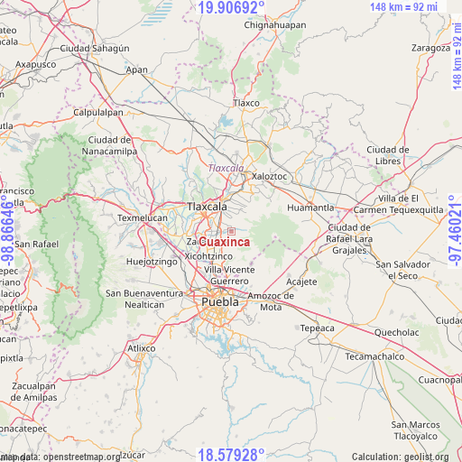
Cuaxinca GPS coordinates[2]
19° 14' 39.984" North, 98° 9' 47.988" West
| Map corner | latitude | longitude |
|---|---|---|
| Upper-left | 19.90692°, | -98.86646° |
| Center: | 19.24444°, | -98.16333° |
| Lower-right: | 18.57928°, | -97.46021° |
| Map W x H: | 147.6×147.6 km | = 91.7×91.7mi |
| max Lat: | 32.7° ⇑60% North |
| Cuaxinca: | 19.24444° |
| min Lat: | ⇓40% South 14.53588° |
| min Long | Cuaxinca | max Long |
| -117.105° | -98.16333° | -86.73105° |
| W 61.7%⇐ | ⇒38.3% E |
Elevation
Elevation of Cuaxinca is 2438 m = 7999 ft, and this is 1184.3 m = 3885 ft above average elevation for this country.
| Max E: |
3497 m = 11473 ft | 9.1% |
| Cuaxinca | 2438 m 7999 ft | |
| Avg. | 1253.7 m = 4113 ft | |
Min E: |
-1 m = -3 ft | 90.9% |
See also: Mexico elevation on elevation.city.
Geographical zone
Cuaxinca is located in North Torrid zone (between Equator and Tropic of Cancer). Distance of this Northern Tropic circle is 466.1 km =289.6 mi to North.| Distance of | km | miles | from Cuaxinca |
|---|---|---|---|
| North Pole | 7867.3 | 4888.5 | to North |
| Arctic Circle | 5261.4 | 3269.3 | to North |
| Tropic Cancer | 466.1 | 289.6 | to North |
| Equator | 2139.8 | 1329.6 | to South |


Nearby cities:
15 places around Cuaxinca: (largest is in red/bold)
• Acuamanala
4.5 km =2.8 mi,  239°
239°
• Acxotla del Monte
1 km =0.6 mi,  331°
331°
• Ayometitla
5.2 km =3.2 mi,  217°
217°
• Concepción Chimalpa
4.8 km =3 mi,  229°
229°
• El Carmen Aztama
6.1 km =3.8 mi,  254°
254°
• Guadalupe Hidalgo
3.3 km =2.1 mi, 231°
• La Magdalena Tlaltelulco
5.5 km =3.4 mi,  321°
321°
• Olextla de Juárez
4.5 km =2.8 mi, 219°
• San Bartolomé Cuahuixmatlac
5.7 km =3.5 mi,  16°
16°
• San Francisco Tetlanohcan
1.8 km =1.1 mi,  358°
358°
• San Marcos Contla
6.3 km =3.9 mi, 217°
• San Pedro Muñoztla
4.2 km =2.6 mi,  354°
354°
• Santa Isabel Xiloxoxtla
5.9 km =3.7 mi,  296°
296°
• Teolocholco
2.9 km =1.8 mi,  267°
267°
• Tetlanohcán
1.8 km =1.1 mi, 356°
Sources, notices
• [Note1] Compared only with cities in Mexico existing in our database
• [Src1] Map data: © OpenStreetMap contributors (CC-BY-SA)
• [Src2] Other city data from geonames.org with taken over terms of usage.
• [Src3] Geographical zone / Annual Mean Temperature by Robert A. Rohde @ Wikipedia
