Veinte de Abril geodata
Veinte de Abril (Chiapas) is a populated place; located in Mexico in America/Mexico_City (GMT-6) time zone. With population of 512 people, there are 16417 cities with bigger population in this country. Compared to other cities in Mexico, 98.9% of cities are located further ↑North; 89.9% of cities are located further ←West and 93.5% of cities have higher elevation than Veinte de Abril. Note1


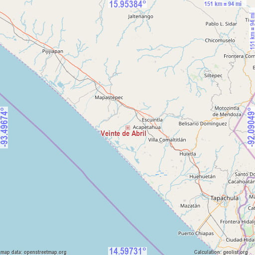
Veinte de Abril GPS coordinates[2]
15° 16' 36.012" North, 92° 47' 36.996" West
| Map corner | latitude | longitude |
|---|---|---|
| Upper-left | 15.95384°, | -93.49674° |
| Center: | 15.27667°, | -92.79361° |
| Lower-right: | 14.59731°, | -92.09049° |
| Map W x H: | 150.8×150.8 km | = 93.7×93.7mi |
| max Lat: | 32.7° ⇑98.9% North |
| Veinte de Abril: | 15.27667° |
| min Lat: | ⇓1.1% South 14.53588° |
| min Long | Veinte de Abril | max Long |
| -117.105° | -92.79361° | -86.73105° |
| W 89.9%⇐ | ⇒10.1% E |
Elevation
Elevation of Veinte de Abril is 16 m = 52 ft, and this is 1237.7 m = 4061 ft below average elevation for this country.
| Max E: |
3497 m = 11473 ft | 93.5% |
| Avg. | 1253.7 m = 4113 ft | |
| Veinte de Abril | 16 m = 52 ft | |
Min E: |
-1 m = -3 ft | 6.5% |
See also: Mexico elevation on elevation.city.
Geographical zone
Veinte de Abril is located in North Torrid zone (between Equator and Tropic of Cancer). Distance of this Northern Tropic circle is 907.3 km =563.8 mi to North.| Distance of | km | miles | from Veinte de Abril |
|---|---|---|---|
| North Pole | 8308.5 | 5162.7 | to North |
| Arctic Circle | 5702.6 | 3543.4 | to North |
| Tropic Cancer | 907.3 | 563.8 | to North |
| Equator | 1698.6 | 1055.5 | to South |


Nearby cities:
15 places around Veinte de Abril: (largest is in red/bold)
• Acapetahua
11.1 km =6.9 mi,  87°
87°
• Barrio Nuevo
11.4 km =7.1 mi,  108°
108°
• El Consuelo Ulapa
12.2 km =7.6 mi,  0°
0°
• El Madronal
9.3 km =5.8 mi, 85°
• Hidalgo
9.8 km =6.1 mi,  34°
34°
• Jiquilpan
5.4 km =3.4 mi,  346°
346°
• Jiquilpan (Estación Bonanza)
8.8 km =5.5 mi, 34°
• La Alianza
13.5 km =8.4 mi,  321°
321°
• La Palma
12.5 km =7.8 mi,  201°
201°
• Las Cruces
6.9 km =4.3 mi, 86°
• Los Amates
13.2 km =8.2 mi,  54°
54°
• Mariano Matamoros
6.2 km =3.9 mi, 112°
• Nicolás Bravo Dos Anexo Emiliano Zapata
8.6 km =5.3 mi, 318°
• Nueva Sesecapa
14.3 km =8.9 mi, 347°
• Soconusco
8.4 km =5.2 mi,  59°
59°
Sources, notices
• [Note1] Compared only with cities in Mexico existing in our database
• [Src1] Map data: © OpenStreetMap contributors (CC-BY-SA)
• [Src2] Other city data from geonames.org with taken over terms of usage.
• [Src3] Geographical zone / Annual Mean Temperature by Robert A. Rohde @ Wikipedia
