La Alianza geodata
La Alianza (Chiapas) is a populated place; located in Mexico in America/Mexico_City (GMT-6) time zone. With population of 806 people, there are 10834 cities with bigger population in this country. Compared to other cities in Mexico, 98.7% of cities are located further ↑North; 89.4% of cities are located further ←West and 90% of cities have higher elevation than La Alianza. Note1


La Alianza GPS coordinates[2]
15° 22' 18.012" North, 92° 52' 18.012" West
| Map corner | latitude | longitude |
|---|---|---|
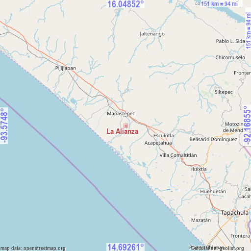
| Upper-left | 16.04852°, | -93.5748° |
| Center: | 15.37167°, | -92.87167° |
| Lower-right: | 14.69261°, | -92.16855° |
| Map W x H: | 150.8×150.8 km | = 93.7×93.7mi |
| max Lat: | 32.7° ⇑98.7% North |
| La Alianza: | 15.37167° |
| min Lat: | ⇓1.3% South 14.53588° |
| min Long | La Alianza | max Long |
| -117.105° | -92.87167° | -86.73105° |
| W 89.4%⇐ | ⇒10.6% E |
Elevation
Elevation of La Alianza is 24 m = 79 ft, and this is 1229.7 m = 4034 ft below average elevation for this country.
| Max E: |
3497 m = 11473 ft | 90% |
| Avg. | 1253.7 m = 4113 ft | |
| La Alianza | 24 m = 79 ft | |
Min E: |
-1 m = -3 ft | 10% |
See also: Mexico elevation on elevation.city.
Geographical zone
La Alianza is located in North Torrid zone (between Equator and Tropic of Cancer). Distance of this Northern Tropic circle is 896.7 km =557.2 mi to North.| Distance of | km | miles | from La Alianza |
|---|---|---|---|
| North Pole | 8297.9 | 5156.1 | to North |
| Arctic Circle | 5692 | 3536.8 | to North |
| Tropic Cancer | 896.7 | 557.2 | to North |
| Equator | 1709.2 | 1062 | to South |


Nearby cities:
15 places around La Alianza: (largest is in red/bold)
• Abraham González
3.1 km =1.9 mi,  257°
257°
• El Consuelo Ulapa
8.7 km =5.4 mi,  78°
78°
• Flores Magón
5.6 km =3.5 mi,  41°
41°
• Generación 2000 Nuevo Milenio
10.9 km =6.8 mi,  347°
347°
• Guadalupe Victoria
14.9 km =9.3 mi,  356°
356°
• Hidalgo
14.1 km =8.8 mi,  99°
99°
• Jiquilpan
8.9 km =5.5 mi,  126°
126°
• Jiquilpan (Estación Bonanza)
13.7 km =8.5 mi, 103°
• Mapastepec
7.5 km =4.7 mi,  335°
335°
• Nicolás Bravo Dos Anexo Emiliano Zapata
4.9 km =3 mi,  146°
146°
• Nueva Costa Rica
12.4 km =7.7 mi,  30°
30°
• Nueva Sesecapa
6.3 km =3.9 mi,  57°
57°
• Nuevo Milenio Valdivia
16.8 km =10.4 mi,  330°
330°
• Soconusco
16.8 km =10.4 mi,  112°
112°
• Veinte de Abril
13.5 km =8.4 mi,  141°
141°
Sources, notices
• [Note1] Compared only with cities in Mexico existing in our database
• [Src1] Map data: © OpenStreetMap contributors (CC-BY-SA)
• [Src2] Other city data from geonames.org with taken over terms of usage.
• [Src3] Geographical zone / Annual Mean Temperature by Robert A. Rohde @ Wikipedia
