Juc'Nil geodata
Juc'Nil (Chiapas) is a populated place; located in Mexico in America/Mexico_City (GMT-6) time zone. With population of 509 people, there are 16517 cities with bigger population in this country. Compared to other cities in Mexico, 88.9% of cities are located further ↑North; 92.7% of cities are located further ←West and 64% of cities have higher elevation than Juc'Nil. Note1


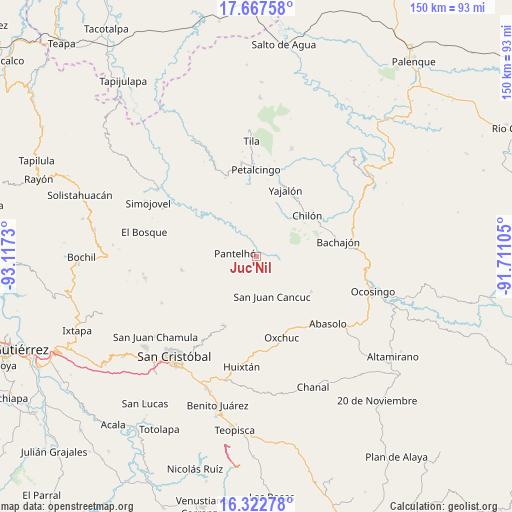
Juc'Nil GPS coordinates[2]
16° 59' 47.004" North, 92° 24' 51.012" West
| Map corner | latitude | longitude |
|---|---|---|
| Upper-left | 17.66758°, | -93.1173° |
| Center: | 16.99639°, | -92.41417° |
| Lower-right: | 16.32278°, | -91.71105° |
| Map W x H: | 149.5×149.5 km | = 92.9×92.9mi |
| max Lat: | 32.7° ⇑88.9% North |
| Juc'Nil: | 16.99639° |
| min Lat: | ⇓11.1% South 14.53588° |
| min Long | Juc'Nil | max Long |
| -117.105° | -92.41417° | -86.73105° |
| W 92.7%⇐ | ⇒7.3% E |
Elevation
Elevation of Juc'Nil is 749 m = 2457 ft, and this is 504.7 m = 1656 ft below average elevation for this country.
| Max E: |
3497 m = 11473 ft | 64% |
| Avg. | 1253.7 m = 4113 ft | |
| Juc'Nil | 749 m = 2457 ft | |
Min E: |
-1 m = -3 ft | 36% |
See also: Mexico elevation on elevation.city.
Geographical zone
Juc'Nil is located in North Torrid zone (between Equator and Tropic of Cancer). Distance of this Northern Tropic circle is 716.1 km =445 mi to North.| Distance of | km | miles | from Juc'Nil |
|---|---|---|---|
| North Pole | 8117.2 | 5043.8 | to North |
| Arctic Circle | 5511.4 | 3424.6 | to North |
| Tropic Cancer | 716.1 | 445 | to North |
| Equator | 1889.8 | 1174.3 | to South |


Nearby cities:
15 places around Juc'Nil: (largest is in red/bold)
• Baquelchán
6.8 km =4.2 mi,  99°
99°
• Cruztón
5.8 km =3.6 mi,  204°
204°
• El Pozo
8.5 km =5.3 mi,  178°
178°
• Golonchán Viejo
5 km =3.1 mi,  38°
38°
• Guayabal
9.2 km =5.7 mi,  233°
233°
• Insurgente Picoté
7.8 km =4.8 mi,  25°
25°
• Iwiltic
2.8 km =1.7 mi, 229°
• La Palma Uno
5.2 km =3.2 mi,  117°
117°
• Miguel Utrilla (Los Chorros)
9.2 km =5.7 mi, 229°
• Oniltic
4.2 km =2.6 mi,  137°
137°
• Pantelhó
6.2 km =3.9 mi,  279°
279°
• Tenango
3.3 km =2.1 mi, 184°
• Tzeltal
9.3 km =5.8 mi, 226°
• Tzunjok
6.2 km =3.9 mi,  151°
151°
• Yocwitz
3.3 km =2.1 mi,  112°
112°
Sources, notices
• [Note1] Compared only with cities in Mexico existing in our database
• [Src1] Map data: © OpenStreetMap contributors (CC-BY-SA)
• [Src2] Other city data from geonames.org with taken over terms of usage.
• [Src3] Geographical zone / Annual Mean Temperature by Robert A. Rohde @ Wikipedia
