Insurgente Picoté geodata
Insurgente Picoté (Chiapas) is a populated place; located in Mexico in America/Mexico_City (GMT-6) time zone. With population of 668 people, there are 12987 cities with bigger population in this country. Compared to other cities in Mexico, 88.1% of cities are located further ↑North; 92.8% of cities are located further ←West and 59.5% of cities have higher elevation than Insurgente Picoté. Note1


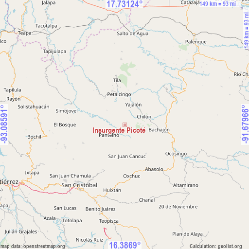
Insurgente Picoté GPS coordinates[2]
17° 3' 37.008" North, 92° 22' 58.008" West
| Map corner | latitude | longitude |
|---|---|---|
| Upper-left | 17.73124°, | -93.08591° |
| Center: | 17.06028°, | -92.38278° |
| Lower-right: | 16.3869°, | -91.67966° |
| Map W x H: | 149.5×149.5 km | = 92.9×92.9mi |
| max Lat: | 32.7° ⇑88.1% North |
| Insurgente Picoté: | 17.06028° |
| min Lat: | ⇓11.9% South 14.53588° |
| min Long | Insurgente Pico | max Long |
| -117.105° | -92.38278° | -86.73105° |
| W 92.8%⇐ | ⇒7.2% E |
Elevation
Elevation of Insurgente Picoté is 1026 m = 3366 ft, and this is 227.7 m = 747 ft below average elevation for this country.
| Max E: |
3497 m = 11473 ft | 59.5% |
| Avg. | 1253.7 m = 4113 ft | |
| Insurgente Picoté | 1026 m = 3366 ft | |
Min E: |
-1 m = -3 ft | 40.5% |
See also: Mexico elevation on elevation.city.
Geographical zone
Insurgente Picoté is located in North Torrid zone (between Equator and Tropic of Cancer). Distance of this Northern Tropic circle is 709 km =440.6 mi to North.| Distance of | km | miles | from Insurgente Picoté |
|---|---|---|---|
| North Pole | 8110.1 | 5039.4 | to North |
| Arctic Circle | 5504.2 | 3420.2 | to North |
| Tropic Cancer | 709 | 440.6 | to North |
| Equator | 1896.9 | 1178.7 | to South |


Nearby cities:
15 places around Insurgente Picoté: (largest is in red/bold)
• Aurora Grande
8.7 km =5.4 mi,  20°
20°
• Baquelchán
8.9 km =5.5 mi,  157°
157°
• El Recreo
9.3 km =5.8 mi,  358°
358°
• Emiliano Zapata
10.2 km =6.3 mi,  338°
338°
• Golonchán Viejo
3.2 km =2 mi,  184°
184°
• Iwiltic
10.5 km =6.5 mi,  211°
211°
• Juan Sabines Verapaz
7.8 km =4.8 mi,  76°
76°
• Juc'Nil
7.8 km =4.8 mi, 205°
• La Palma Uno
9.6 km =6 mi,  172°
172°
• Oniltic
10.2 km =6.3 mi, 182°
• Santa Cruz la Reforma
9.1 km =5.7 mi,  94°
94°
• Sitalá
9 km =5.6 mi,  116°
116°
• Tacuba Nueva
3.6 km =2.2 mi, 21°
• Tzajalá
8.4 km =5.2 mi,  352°
352°
• Yocwitz
8.3 km =5.2 mi, 182°
Sources, notices
• [Note1] Compared only with cities in Mexico existing in our database
• [Src1] Map data: © OpenStreetMap contributors (CC-BY-SA)
• [Src2] Other city data from geonames.org with taken over terms of usage.
• [Src3] Geographical zone / Annual Mean Temperature by Robert A. Rohde @ Wikipedia
