San Juan Bautista geodata
San Juan Bautista (Chiapas) is a populated place; located in Mexico in America/Mexico_City (GMT-6) time zone. With population of 506 people, there are 16626 cities with bigger population in this country. Compared to other cities in Mexico, 94.6% of cities are located further ↑North; 96.1% of cities are located further ←West and 52.6% of cities have higher elevation than San Juan Bautista. Note1


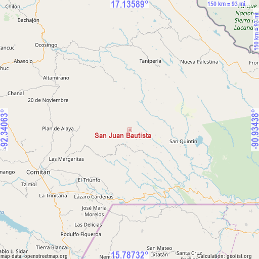
San Juan Bautista GPS coordinates[2]
16° 27' 46.008" North, 91° 38' 15" West
| Map corner | latitude | longitude |
|---|---|---|
| Upper-left | 17.13589°, | -92.34063° |
| Center: | 16.46278°, | -91.6375° |
| Lower-right: | 15.78732°, | -90.93438° |
| Map W x H: | 149.9×149.9 km | = 93.1×93.1mi |
| max Lat: | 32.7° ⇑94.6% North |
| San Juan Bautista: | 16.46278° |
| min Lat: | ⇓5.4% South 14.53588° |
| min Long | San Juan Bautis | max Long |
| -117.105° | -91.6375° | -86.73105° |
| W 96.1%⇐ | ⇒3.9% E |
Elevation
Elevation of San Juan Bautista is 1312 m = 4304 ft, and this is 58.3 m = 191 ft above average elevation for this country.
| Max E: |
3497 m = 11473 ft | 52.6% |
| San Juan Bautista | 1312 m 4304 ft | |
| Avg. | 1253.7 m = 4113 ft | |
Min E: |
-1 m = -3 ft | 47.4% |
See also: Mexico elevation on elevation.city.
Geographical zone
San Juan Bautista is located in North Torrid zone (between Equator and Tropic of Cancer). Distance of this Northern Tropic circle is 775.4 km =481.8 mi to North.| Distance of | km | miles | from San Juan Bautista |
|---|---|---|---|
| North Pole | 8176.6 | 5080.7 | to North |
| Arctic Circle | 5570.7 | 3461.5 | to North |
| Tropic Cancer | 775.4 | 481.8 | to North |
| Equator | 1830.5 | 1137.4 | to South |


Nearby cities:
15 places around San Juan Bautista: (largest is in red/bold)
• El Edén
19 km =11.8 mi,  180°
180°
• Luis Espinoza
14 km =8.7 mi,  6°
6°
• Nuevo Momón
18.6 km =11.6 mi,  217°
217°
• Plan de Santo Tomás
8 km =5 mi,  133°
133°
• Río Corozal
6 km =3.7 mi,  57°
57°
• San Bartolo (El Puerto)
17.7 km =11 mi,  68°
68°
• San Francisco
18.7 km =11.6 mi,  326°
326°
• San Isidro
14.8 km =9.2 mi, 181°
• San Juan Rómulo Calzada
19 km =11.8 mi, 8°
• San Juan del Pozo
8.9 km =5.5 mi,  242°
242°
• San Luis Potosí
15.7 km =9.8 mi,  356°
356°
• San Marcos
20.4 km =12.7 mi, 334°
• Santa Lucía Ojo de Agua
11.1 km =6.9 mi,  137°
137°
• Santa Rita Invernadero
12.9 km =8 mi,  115°
115°
• Vicente Guerrero
9.6 km =6 mi,  204°
204°
Sources, notices
• [Note1] Compared only with cities in Mexico existing in our database
• [Src1] Map data: © OpenStreetMap contributors (CC-BY-SA)
• [Src2] Other city data from geonames.org with taken over terms of usage.
• [Src3] Geographical zone / Annual Mean Temperature by Robert A. Rohde @ Wikipedia
