San Martín Tlamapa geodata
San Martín Tlamapa (Puebla) is a populated place; located in Mexico in America/Mexico_City (GMT-6) time zone. With population of 1,636 people, there are 5292 cities with bigger population in this country. Compared to other cities in Mexico, 65.1% of cities are located further ↑North; 58.7% of cities are located further ←West and 79.5% of cities have lower elevation than San Martín Tlamapa. Note1


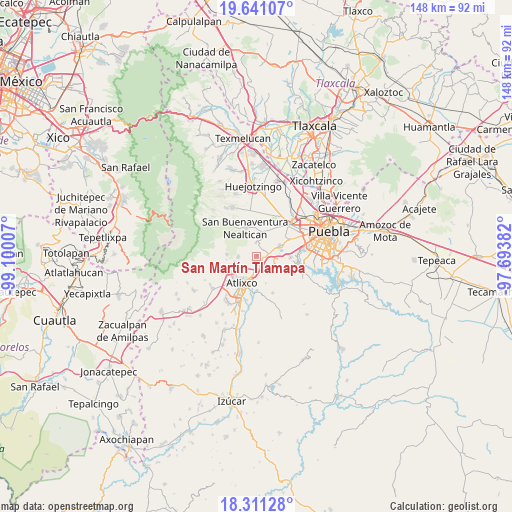
San Martín Tlamapa GPS coordinates[2]
18° 58' 39" North, 98° 23' 48.984" West
| Map corner | latitude | longitude |
|---|---|---|
| Upper-left | 19.64107°, | -99.10007° |
| Center: | 18.9775°, | -98.39694° |
| Lower-right: | 18.31128°, | -97.69382° |
| Map W x H: | 147.9×147.9 km | = 91.9×91.9mi |
| max Lat: | 32.7° ⇑65.1% North |
| San Martín Tlamapa: | 18.9775° |
| min Lat: | ⇓34.9% South 14.53588° |
| min Long | San Martín Tla | max Long |
| -117.105° | -98.39694° | -86.73105° |
| W 58.7%⇐ | ⇒41.3% E |
Elevation
Elevation of San Martín Tlamapa is 2127 m = 6978 ft, and this is 873.3 m = 2865 ft above average elevation for this country.
| Max E: |
3497 m = 11473 ft | 20.5% |
| San Martín Tlamapa | 2127 m 6978 ft | |
| Avg. | 1253.7 m = 4113 ft | |
Min E: |
-1 m = -3 ft | 79.5% |
See also: Mexico elevation on elevation.city.
Geographical zone
San Martín Tlamapa is located in North Torrid zone (between Equator and Tropic of Cancer). Distance of this Northern Tropic circle is 495.8 km =308.1 mi to North.| Distance of | km | miles | from San Martín Tlamapa |
|---|---|---|---|
| North Pole | 7897 | 4907 | to North |
| Arctic Circle | 5291.1 | 3287.7 | to North |
| Tropic Cancer | 495.8 | 308.1 | to North |
| Equator | 2110.1 | 1311.2 | to South |


Nearby cities:
15 places around San Martín Tlamapa: (largest is in red/bold)
• Acuexcomac
6.8 km =4.2 mi,  10°
10°
• Chalchihuapan
6.3 km =3.9 mi,  95°
95°
• El Encanto del Cerril
5.9 km =3.7 mi,  210°
210°
• Emiliano Zapata los Molinos
3.3 km =2.1 mi,  174°
174°
• Los Reyes Tlanechicolpan
7.7 km =4.8 mi,  37°
37°
• San Agustín Huixaxtla
6.6 km =4.1 mi,  180°
180°
• San Bernabé Temoxtitla
7.3 km =4.5 mi,  72°
72°
• San Gregorio Atzompa
7.2 km =4.5 mi,  45°
45°
• San Juan Portezuelo
7.5 km =4.7 mi,  146°
146°
• San Martín Tlapala
6.6 km =4.1 mi,  259°
259°
• San Pablo Ahuatempa
4 km =2.5 mi,  83°
83°
• Santa Ana Acozautla
2.8 km =1.7 mi, 149°
• Santa Isabel Cholula
2.8 km =1.7 mi, 40°
• Tecuanipan
4 km =2.5 mi,  357°
357°
• Tianguismanalco
5.4 km =3.4 mi,  268°
268°
Sources, notices
• [Note1] Compared only with cities in Mexico existing in our database
• [Src1] Map data: © OpenStreetMap contributors (CC-BY-SA)
• [Src2] Other city data from geonames.org with taken over terms of usage.
• [Src3] Geographical zone / Annual Mean Temperature by Robert A. Rohde @ Wikipedia
