San Bartolo Coyotespec geodata
San Bartolo Coyotespec (Oaxaca) is a populated place; located in Mexico in America/Mexico_City (GMT-6) time zone. With population of 3,981 people, there are 2288 cities with bigger population in this country. Compared to other cities in Mexico, 89.5% of cities are located further ↑North; 78.3% of cities are located further ←West and 52% of cities have lower elevation than San Bartolo Coyotespec. Note1
Current local time in San Bartolo Coyotespec:
08:33 AM, WednesdayDifference from your time zone: hours


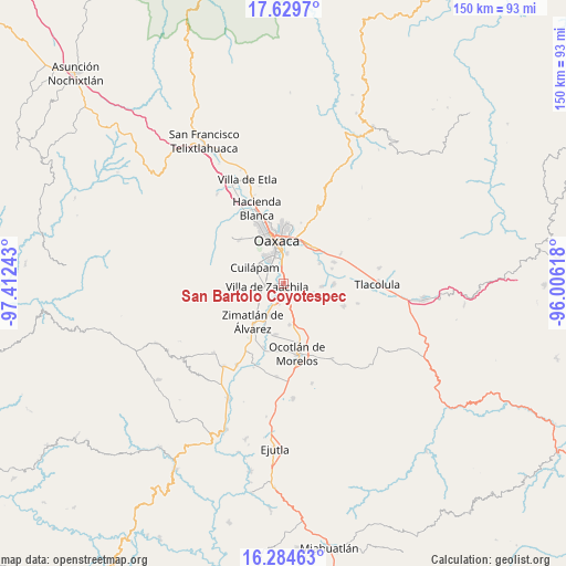
San Bartolo Coyotespec GPS coordinates[2]
16° 57' 30.132" North, 96° 42' 33.48" West
| Map corner | latitude | longitude |
|---|---|---|
| Upper-left | 17.6297°, | -97.41243° |
| Center: | 16.95837°, | -96.7093° |
| Lower-right: | 16.28463°, | -96.00618° |
| Map W x H: | 149.6×149.6 km | = 93×93mi |
| max Lat: | 32.7° ⇑89.5% North |
| San Bartolo Coyotespec: | 16.95837° |
| min Lat: | ⇓10.5% South 14.53588° |
| min Long | San Bartolo Coy | max Long |
| -117.105° | -96.7093° | -86.73105° |
| W 78.3%⇐ | ⇒21.7% E |
Elevation
Elevation of San Bartolo Coyotespec is 1525 m = 5003 ft, and this is 271.3 m = 890 ft above average elevation for this country.
| Max E: |
3497 m = 11473 ft | 48% |
| San Bartolo Coyotespec | 1525 m 5003 ft | |
| Avg. | 1253.7 m = 4113 ft | |
Min E: |
-1 m = -3 ft | 52% |
See also: Mexico elevation on elevation.city.
Geographical zone
San Bartolo Coyotespec is located in North Torrid zone (between Equator and Tropic of Cancer). Distance of this Northern Tropic circle is 720.3 km =447.6 mi to North.| Distance of | km | miles | from San Bartolo Coyotespec |
|---|---|---|---|
| North Pole | 8121.5 | 5046.5 | to North |
| Arctic Circle | 5515.6 | 3427.2 | to North |
| Tropic Cancer | 720.3 | 447.6 | to North |
| Equator | 1885.6 | 1171.7 | to South |


Nearby cities:
15 places around San Bartolo Coyotespec: (largest is in red/bold)
• Animas Trujano
3.6 km =2.2 mi,  353°
353°
• Colonia 24 de Julio
4.1 km =2.5 mi,  162°
162°
• Colonia el Manantial
4.6 km =2.9 mi, 155°
• Cuarta Sección
2.2 km =1.4 mi, 161°
• Emiliano Zapata
2.7 km =1.7 mi,  196°
196°
• Ninguno
4.2 km =2.6 mi,  174°
174°
• Reyes Mantecón
6 km =3.7 mi, 198°
• San Agustin de las Juntas
5.1 km =3.2 mi,  1°
1°
• San Agustín de las Juntas
6 km =3.7 mi,  357°
357°
• San Isidro Monjas
6.4 km =4 mi,  319°
319°
• San Juan Bautista la Raya
3.5 km =2.2 mi,  332°
332°
• San Raymundo Jalpam
5.3 km =3.3 mi,  286°
286°
• Santa María Coyotepec
1 km =0.6 mi,  25°
25°
• Vicente Guerrero
2.9 km =1.8 mi, 163°
• Villa de Zaachila
4.3 km =2.7 mi,  259°
259°
Sources, notices
• [Note1] Compared only with cities in Mexico existing in our database
• [Src1] Map data: © OpenStreetMap contributors (CC-BY-SA)
• [Src2] Other city data from geonames.org with taken over terms of usage.
• [Src3] Geographical zone / Annual Mean Temperature by Robert A. Rohde @ Wikipedia
