Capellanía de Loera geodata
Capellanía de Loera (Guanajuato) is a populated place; located in Mexico in America/Mexico_City (GMT-6) time zone. With population of 916 people, there are 9527 cities with bigger population in this country. Compared to other cities in Mexico, 77% of cities are located further ↓South; 78.2% of cities are located further →East and 64.4% of cities have lower elevation than Capellanía de Loera. Note1


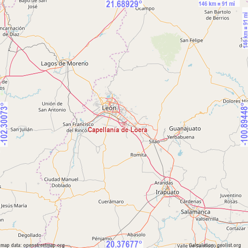
Capellanía de Loera GPS coordinates[2]
21° 2' 4.128" North, 101° 35' 51.36" West
| Map corner | latitude | longitude |
|---|---|---|
| Upper-left | 21.68929°, | -102.30073° |
| Center: | 21.03448°, | -101.5976° |
| Lower-right: | 20.37677°, | -100.89448° |
| Map W x H: | 145.9×145.9 km | = 90.7×90.7mi |
| max Lat: | 32.7° ⇑23% North |
| Capellanía de Loera: | 21.03448° |
| min Lat: | ⇓77% South 14.53588° |
| min Long | Capellanía de | max Long |
| -117.105° | -101.5976° | -86.73105° |
| W 21.8%⇐ | ⇒78.2% E |
Elevation
Elevation of Capellanía de Loera is 1810 m = 5938 ft, and this is 556.3 m = 1825 ft above average elevation for this country.
| Max E: |
3497 m = 11473 ft | 35.6% |
| Capellanía de Loera | 1810 m 5938 ft | |
| Avg. | 1253.7 m = 4113 ft | |
Min E: |
-1 m = -3 ft | 64.4% |
See also: Mexico elevation on elevation.city.
Geographical zone
Capellanía de Loera is located in North Torrid zone (between Equator and Tropic of Cancer). Distance of this Northern Tropic circle is 267.1 km =166 mi to North.| Distance of | km | miles | from Capellanía de Loera |
|---|---|---|---|
| North Pole | 7668.2 | 4764.8 | to North |
| Arctic Circle | 5062.4 | 3145.6 | to North |
| Tropic Cancer | 267.1 | 166 | to North |
| Equator | 2338.8 | 1453.3 | to South |


Nearby cities:
15 places around Capellanía de Loera: (largest is in red/bold)
• Arboledas de los López Primera Sección
1.9 km =1.2 mi,  48°
48°
• El Refugio de los Sauces
7.3 km =4.5 mi,  107°
107°
• El Resplandor
3.7 km =2.3 mi,  192°
192°
• Guadalupe Victoria
2.5 km =1.6 mi,  132°
132°
• Ladrilleras del Refugio
7.2 km =4.5 mi,  39°
39°
• Lomas de Comanjilla
7.1 km =4.4 mi,  91°
91°
• Lomas de la Loza
5.5 km =3.4 mi, 54°
• Los Ramírez
5.1 km =3.2 mi,  250°
250°
• Loza de los Padres
6.8 km =4.2 mi, 52°
• Noria de Septién (San José de San Juan)
5.6 km =3.5 mi,  303°
303°
• Nueva Colonia San Carlos
1.7 km =1.1 mi,  15°
15°
• San Antonio de los Tepetates
8.2 km =5.1 mi,  277°
277°
• San Francisco de Durán
4 km =2.5 mi,  215°
215°
• San Isidro de los Sauces
6.4 km =4 mi,  103°
103°
• San Juan de Abajo
4.6 km =2.9 mi, 301°
Sources, notices
• [Note1] Compared only with cities in Mexico existing in our database
• [Src1] Map data: © OpenStreetMap contributors (CC-BY-SA)
• [Src2] Other city data from geonames.org with taken over terms of usage.
• [Src3] Geographical zone / Annual Mean Temperature by Robert A. Rohde @ Wikipedia
