El Resplandor geodata
El Resplandor (Guanajuato) is a populated place; located in Mexico in America/Mexico_City (GMT-6) time zone. With population of 738 people, there are 11838 cities with bigger population in this country. Compared to other cities in Mexico, 76.5% of cities are located further ↓South; 78.2% of cities are located further →East and 63.8% of cities have lower elevation than El Resplandor. Note1


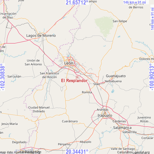
El Resplandor GPS coordinates[2]
21° 0' 7.776" North, 101° 36' 18.9" West
| Map corner | latitude | longitude |
|---|---|---|
| Upper-left | 21.65712°, | -102.30838° |
| Center: | 21.00216°, | -101.60525° |
| Lower-right: | 20.34431°, | -100.90213° |
| Map W x H: | 146×146 km | = 90.7×90.7mi |
| max Lat: | 32.7° ⇑23.5% North |
| El Resplandor: | 21.00216° |
| min Lat: | ⇓76.5% South 14.53588° |
| min Long | El Resplandor | max Long |
| -117.105° | -101.60525° | -86.73105° |
| W 21.8%⇐ | ⇒78.2% E |
Elevation
Elevation of El Resplandor is 1797 m = 5896 ft, and this is 543.3 m = 1782 ft above average elevation for this country.
| Max E: |
3497 m = 11473 ft | 36.2% |
| El Resplandor | 1797 m 5896 ft | |
| Avg. | 1253.7 m = 4113 ft | |
Min E: |
-1 m = -3 ft | 63.8% |
See also: Mexico elevation on elevation.city.
Geographical zone
El Resplandor is located in North Torrid zone (between Equator and Tropic of Cancer). Distance of this Northern Tropic circle is 270.7 km =168.2 mi to North.| Distance of | km | miles | from El Resplandor |
|---|---|---|---|
| North Pole | 7671.8 | 4767 | to North |
| Arctic Circle | 5066 | 3147.9 | to North |
| Tropic Cancer | 270.7 | 168.2 | to North |
| Equator | 2335.2 | 1451 | to South |


Nearby cities:
15 places around El Resplandor: (largest is in red/bold)
• Arboledas de los López Primera Sección
5.3 km =3.3 mi,  24°
24°
• Barretos
8 km =5 mi,  209°
209°
• Capellanía de Loera
3.7 km =2.3 mi,  12°
12°
• El Refugio de los Sauces
7.9 km =4.9 mi,  79°
79°
• Guadalupe Victoria
3.3 km =2.1 mi,  54°
54°
• La Arcina
6.8 km =4.2 mi,  187°
187°
• Los Ramírez
4.5 km =2.8 mi,  295°
295°
• Loza de Barrera
8.1 km =5 mi,  103°
103°
• Noria de Septién (San José de San Juan)
7.7 km =4.8 mi,  330°
330°
• Nueva Colonia San Carlos
5.3 km =3.3 mi, 13°
• Nuevo Lindero
5.9 km =3.7 mi, 214°
• Rancho Nuevo de la Luz
6.1 km =3.8 mi,  223°
223°
• San Francisco de Durán
1.6 km =1 mi,  282°
282°
• San Isidro de los Sauces
7.4 km =4.6 mi,  73°
73°
• San Juan de Abajo
6.8 km =4.2 mi, 332°
Sources, notices
• [Note1] Compared only with cities in Mexico existing in our database
• [Src1] Map data: © OpenStreetMap contributors (CC-BY-SA)
• [Src2] Other city data from geonames.org with taken over terms of usage.
• [Src3] Geographical zone / Annual Mean Temperature by Robert A. Rohde @ Wikipedia
