Simpang Empat geodata
Simpang Empat (Perak) is a populated place; located in Malaysia in Asia/Kuala_Lumpur (GMT+8) time zone. With population of 58,004 people, there are 59 cities with bigger population in this country. Compared to other cities in Malaysia, 63.5% of cities are located further ↓South; 79.8% of cities are located further →East and 96.6% of cities have higher elevation than Simpang Empat. Note1


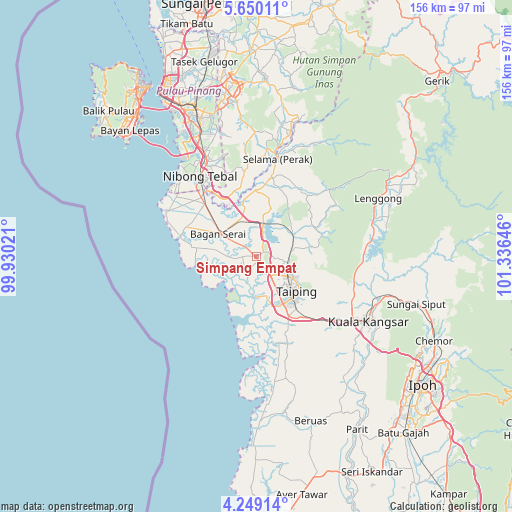
Simpang Empat GPS coordinates[2]
4° 57' 0" North, 100° 37' 59.988" East
| Map corner | latitude | longitude |
|---|---|---|
| Upper-left | 5.65011°, | 99.93021° |
| Center: | 4.95°, | 100.63333° |
| Lower-right: | 4.24914°, | 101.33646° |
| Map W x H: | 155.8×155.8 km | = 96.8×96.8mi |
| max Lat: | 6.88732° ⇑36.5% North |
| Simpang Empat: | 4.95° |
| min Lat: | ⇓63.5% South 1.24722° |
| min Long | Simpang Empat | max Long |
| 99.68252° | 100.63333° | 118.61119° |
| W 20.2%⇐ | ⇒79.8% E |
Elevation
Elevation of Simpang Empat is 4 m = 13 ft, and this is 40.7 m = 134 ft below average elevation for this country.
| Max E: |
1488 m = 4882 ft | 96.6% |
| Avg. | 44.7 m = 147 ft | |
| Simpang Empat | 4 m = 13 ft | |
Min E: |
0 m = 0 ft | 3.4% |
See also: Simpang Empat elevation on elevation.city.
Geographical zone
Simpang Empat is located in North Torrid zone (between Equator and Tropic of Cancer). Distance of Equator is 550.4 km =342 mi to South.| Distance of | km | miles | from Simpang Empat |
|---|---|---|---|
| North Pole | 9456.7 | 5876.1 | to North |
| Arctic Circle | 6850.8 | 4256.9 | to North |
| Tropic Cancer | 2055.5 | 1277.2 | to North |
| Equator | 550.4 | 342 | to South |


Nearby cities:
15 places around Simpang Empat: (largest is in red/bold)
• Bagan Serai
12.3 km =7.6 mi,  303°
303°
• Bukit Mertajam
49.5 km =30.8 mi,  338°
338°
• Butterworth
58.2 km =36.2 mi,  329°
329°
• George Town
61 km =37.9 mi, 327°
• Juru
45.5 km =28.3 mi, 332°
• Kampung Sungai Ara
57.8 km =35.9 mi,  316°
316°
• Kuala Kangsar
39 km =24.2 mi,  121°
121°
• Kulim
46.8 km =29.1 mi,  350°
350°
• Nibong Tebal
29.5 km =18.3 mi, 324°
• Pantai Remis
55 km =34.2 mi,  180°
180°
• Parit Buntar
25 km =15.5 mi, 321°
• Perai
55.6 km =34.5 mi, 330°
• Permatang Kuching
63.5 km =39.5 mi, 333°
• Taiping
15.7 km =9.8 mi,  135°
135°
• Tasek Glugor
60.8 km =37.8 mi, 345°
Sources, notices
• [Note1] Compared only with cities in Malaysia existing in our database
• [Src1] Map data: © OpenStreetMap contributors (CC-BY-SA)
• [Src2] Other city data from geonames.org with taken over terms of usage.
• [Src3] Geographical zone / Annual Mean Temperature by Robert A. Rohde @ Wikipedia
