Inhambane geodata
Inhambane is a seat of a first-order administrative division; located in Mozambique in Africa/Maputo (GMT+2) time zone. With population of 73,884 people, there are 16 cities with bigger population in this country. Compared to other cities in Mozambique, 69.2% of cities are located further ↑North; 53.8% of cities are located further ←West and 88.5% of cities have higher elevation than Inhambane. Note1


Inhambane GPS coordinates[2]
23° 51' 54" South, 35° 22' 59.988" East
| Map corner | latitude | longitude |
|---|---|---|
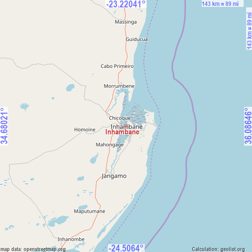
| Upper-left | -23.22041°, | 34.68021° |
| Center: | -23.865°, | 35.38333° |
| Lower-right: | -24.5064°, | 36.08646° |
| Map W x H: | 143×143 km | = 88.9×88.9mi |
| max Lat: | -11.31667° ⇑69.2% North |
| Inhambane: | -23.865° |
| min Lat: | ⇓30.8% South -25.96553° |
| min Long | Inhambane | max Long |
| 31.99528° | 35.38333° | 40.73583° |
| W 53.8%⇐ | ⇒46.2% E |
Elevation
Elevation of Inhambane is 8 m = 26 ft, and this is 211.5 m = 694 ft below average elevation for this country.
| Max E: |
1349 m = 4426 ft | 88.5% |
| Avg. | 219.5 m = 720 ft | |
| Inhambane | 8 m = 26 ft | |
Min E: |
4 m = 13 ft | 11.5% |
See also: Inhambane elevation on elevation.city.
Geographical zone
Inhambane is located in South temperate zone (between Tropic of Capricorn and the Antarctic Circle). Distance of this Southern Tropic circle is 47.6 km =29.6 mi to North.| Distance of | km | miles | from Inhambane |
|---|---|---|---|
| Equator | 2653.5 | 1648.8 | to North |
| Tropic Capricorn | 47.6 | 29.6 | to North |
| Antarctic Circle | 4747.6 | 2950 | to South |
| South Pole | 7353.5 | 4569.3 | to South |


Nearby cities:
9 places around Inhambane: (largest is in red/bold)
• Chibuto
208.8 km =129.7 mi,  244°
244°
• Chokwé
254.5 km =158.1 mi,  253°
253°
• Macia
264.9 km =164.6 mi, 240°
• Manhiça
311.4 km =193.5 mi, 236°
• Maputo
366.4 km =227.7 mi,  230°
230°
• Matola
375.9 km =233.6 mi, 231°
• Maxixe
3.7 km =2.3 mi,  279°
279°
• Ressano Garcia
384.7 km =239 mi, 242°
• Xai-Xai
220 km =136.7 mi, 233°
Sources, notices
• [Note1] Compared only with cities in Mozambique existing in our database
• [Src1] Map data: © OpenStreetMap contributors (CC-BY-SA)
• [Src2] Other city data from geonames.org with taken over terms of usage.
• [Src3] Geographical zone / Annual Mean Temperature by Robert A. Rohde @ Wikipedia
