Wannune geodata
Wannune (Benue) is a seat of a second-order administrative division; located in Nigeria in Africa/Lagos (GMT+1) time zone. In our database, there are 451 cities with bigger population. Compared to other cities in Nigeria, 59.9% of cities are located further ↑North; 75.7% of cities are located further ←West and 62.5% of cities have higher elevation than Wannune. Note1


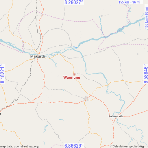
Wannune GPS coordinates[2]
7° 33' 49.824" North, 8° 53' 7.224" East
| Map corner | latitude | longitude |
|---|---|---|
| Upper-left | 8.26027°, | 8.18221° |
| Center: | 7.56384°, | 8.88534° |
| Lower-right: | 6.86629°, | 9.58846° |
| Map W x H: | 155×155 km | = 96.3×96.3mi |
| max Lat: | 13.7543° ⇑59.9% North |
| Wannune: | 7.56384° |
| min Lat: | ⇓40.1% South 4.31231° |
| min Long | Wannune | max Long |
| 2.73333° | 8.88534° | 14.46552° |
| W 75.7%⇐ | ⇒24.3% E |
Elevation
Elevation of Wannune is 191 m = 627 ft, and this is 105.5 m = 346 ft below average elevation for this country.
| Max E: |
1599 m = 5246 ft | 62.5% |
| Avg. | 296.5 m = 973 ft | |
| Wannune | 191 m = 627 ft | |
Min E: |
2 m = 7 ft | 37.5% |
See also: Nigeria elevation on elevation.city.
Geographical zone
Wannune is located in North Torrid zone (between Equator and Tropic of Cancer). Distance of Equator is 841 km =522.6 mi to South.| Distance of | km | miles | from Wannune |
|---|---|---|---|
| North Pole | 9166 | 5695.5 | to North |
| Arctic Circle | 6560.2 | 4076.3 | to North |
| Tropic Cancer | 1764.9 | 1096.7 | to North |
| Equator | 841 | 522.6 | to South |


Nearby cities:
15 places around Wannune: (largest is in red/bold)
• Aliade
53.4 km =33.2 mi,  236°
236°
• Awe
66.3 km =41.2 mi,  25°
25°
• Buruku
37 km =23 mi,  108°
108°
• Gbajimba
28.7 km =17.8 mi,  354°
354°
• Gboko
29.7 km =18.5 mi,  154°
154°
• Igbor
33 km =20.5 mi,  247°
247°
• Katsina-Ala
62.1 km =38.6 mi,  134°
134°
• Keana
65.6 km =40.8 mi, 351°
• Lessel
50.8 km =31.6 mi,  163°
163°
• Makurdi
44.3 km =27.5 mi,  295°
295°
• Naka
75.1 km =46.7 mi,  271°
271°
• Tse-Agberagba
59.3 km =36.8 mi,  204°
204°
• Ugba
51.4 km =31.9 mi,  97°
97°
• Yandev
28.2 km =17.5 mi,  142°
142°
• Zaki Biam
80.2 km =49.8 mi,  94°
94°
Sources, notices
• [Note1] Compared only with cities in Nigeria existing in our database
• [Src1] Map data: © OpenStreetMap contributors (CC-BY-SA)
• [Src2] Other city data from geonames.org with taken over terms of usage.
• [Src3] Geographical zone / Annual Mean Temperature by Robert A. Rohde @ Wikipedia
