Igbor geodata
Igbor (Benue) is a populated place; located in Nigeria in Africa/Lagos (GMT+1) time zone. With population of 17,666 people, there are 212 cities with bigger population in this country. Compared to other cities in Nigeria, 62.9% of cities are located further ↑North; 73% of cities are located further ←West and 59.4% of cities have higher elevation than Igbor. Note1


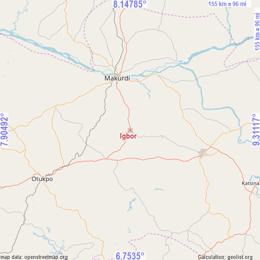
Igbor GPS coordinates[2]
7° 27' 4.428" North, 8° 36' 28.98" East
| Map corner | latitude | longitude |
|---|---|---|
| Upper-left | 8.14785°, | 7.90492° |
| Center: | 7.45123°, | 8.60805° |
| Lower-right: | 6.7535°, | 9.31117° |
| Map W x H: | 155×155 km | = 96.3×96.3mi |
| max Lat: | 13.7543° ⇑62.9% North |
| Igbor: | 7.45123° |
| min Lat: | ⇓37.1% South 4.31231° |
| min Long | Igbor | max Long |
| 2.73333° | 8.60805° | 14.46552° |
| W 73%⇐ | ⇒27% E |
Elevation
Elevation of Igbor is 212 m = 696 ft, and this is 84.5 m = 277 ft below average elevation for this country.
| Max E: |
1599 m = 5246 ft | 59.4% |
| Avg. | 296.5 m = 973 ft | |
| Igbor | 212 m = 696 ft | |
Min E: |
2 m = 7 ft | 40.6% |
See also: Nigeria elevation on elevation.city.
Geographical zone
Igbor is located in North Torrid zone (between Equator and Tropic of Cancer). Distance of Equator is 828.5 km =514.8 mi to South.| Distance of | km | miles | from Igbor |
|---|---|---|---|
| North Pole | 9178.6 | 5703.3 | to North |
| Arctic Circle | 6572.7 | 4084.1 | to North |
| Tropic Cancer | 1777.4 | 1104.4 | to North |
| Equator | 828.5 | 514.8 | to South |


Nearby cities:
15 places around Igbor: (largest is in red/bold)
• Aliade
22.1 km =13.7 mi,  218°
218°
• Boju
79.6 km =49.5 mi,  262°
262°
• Buruku
65.8 km =40.9 mi,  89°
89°
• Gbajimba
49.5 km =30.8 mi,  34°
34°
• Gboko
45.6 km =28.3 mi,  108°
108°
• Keana
80.1 km =49.8 mi,  14°
14°
• Lessel
58 km =36 mi,  128°
128°
• Makurdi
32.8 km =20.4 mi,  343°
343°
• Naka
46.9 km =29.1 mi,  288°
288°
• Obarike-Ito
56.9 km =35.4 mi,  213°
213°
• Ochobo
75.3 km =46.8 mi,  246°
246°
• Oju
70.5 km =43.8 mi,  197°
197°
• Tse-Agberagba
42.1 km =26.2 mi,  171°
171°
• Wannune
33 km =20.5 mi,  67°
67°
• Yandev
48.9 km =30.4 mi,  101°
101°
Sources, notices
• [Note1] Compared only with cities in Nigeria existing in our database
• [Src1] Map data: © OpenStreetMap contributors (CC-BY-SA)
• [Src2] Other city data from geonames.org with taken over terms of usage.
• [Src3] Geographical zone / Annual Mean Temperature by Robert A. Rohde @ Wikipedia
