Ikot Ibritam geodata
Ikot Ibritam (Akwa Ibom) is a seat of a second-order administrative division; located in Nigeria in Africa/Lagos (GMT+1) time zone. In our database, there are 451 cities with bigger population. Compared to other cities in Nigeria, 96.4% of cities are located further ↑North; 55.7% of cities are located further ←West and 90.6% of cities have higher elevation than Ikot Ibritam. Note1


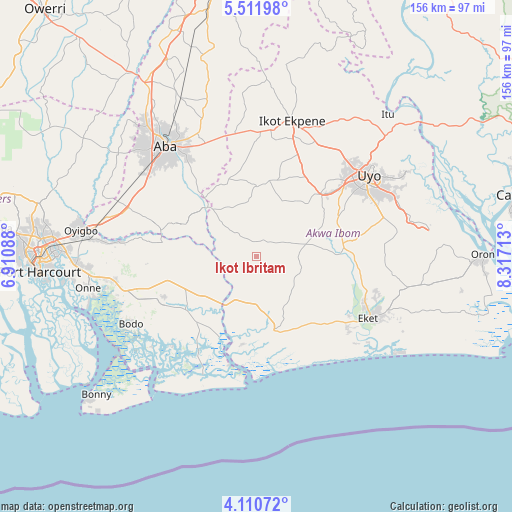
Ikot Ibritam GPS coordinates[2]
4° 48' 42.156" North, 7° 36' 50.436" East
| Map corner | latitude | longitude |
|---|---|---|
| Upper-left | 5.51198°, | 6.91088° |
| Center: | 4.81171°, | 7.61401° |
| Lower-right: | 4.11072°, | 8.31713° |
| Map W x H: | 155.8×155.8 km | = 96.8×96.8mi |
| max Lat: | 13.7543° ⇑96.4% North |
| Ikot Ibritam: | 4.81171° |
| min Lat: | ⇓3.6% South 4.31231° |
| min Long | Ikot Ibritam | max Long |
| 2.73333° | 7.61401° | 14.46552° |
| W 55.7%⇐ | ⇒44.3% E |
Elevation
Elevation of Ikot Ibritam is 27 m = 89 ft, and this is 269.5 m = 884 ft below average elevation for this country.
| Max E: |
1599 m = 5246 ft | 90.6% |
| Avg. | 296.5 m = 973 ft | |
| Ikot Ibritam | 27 m = 89 ft | |
Min E: |
2 m = 7 ft | 9.4% |
See also: Nigeria elevation on elevation.city.
Geographical zone
Ikot Ibritam is located in North Torrid zone (between Equator and Tropic of Cancer). Distance of Equator is 535 km =332.4 mi to South.| Distance of | km | miles | from Ikot Ibritam |
|---|---|---|---|
| North Pole | 9472 | 5885.6 | to North |
| Arctic Circle | 6866.2 | 4266.5 | to North |
| Tropic Cancer | 2070.9 | 1286.8 | to North |
| Equator | 535 | 332.4 | to South |


Nearby cities:
15 places around Ikot Ibritam: (largest is in red/bold)
• Abak
27.1 km =16.8 mi,  45°
45°
• Afaha Ikot Ebak
35.2 km =21.9 mi,  7°
7°
• Afaha Offiong
32.9 km =20.4 mi,  80°
80°
• Afam
33.6 km =20.9 mi,  265°
265°
• Akwete
29.7 km =18.5 mi,  286°
286°
• Bori
31.4 km =19.5 mi,  241°
241°
• Etinan
26.6 km =16.5 mi, 82°
• Ikot Abasi
27.9 km =17.3 mi,  194°
194°
• Ikot Akpa Nkuk
8.7 km =5.4 mi,  320°
320°
• Mkpat Enin
17.2 km =10.7 mi,  119°
119°
• Oke-Ikpe
34.5 km =21.4 mi, 289°
• Okoroete
33.6 km =20.9 mi,  153°
153°
• Opobo
34.2 km =21.3 mi, 194°
• Urua Inyang
24.9 km =15.5 mi,  340°
340°
• Utu Etim Ekpo
21.5 km =13.4 mi,  358°
358°
Sources, notices
• [Note1] Compared only with cities in Nigeria existing in our database
• [Src1] Map data: © OpenStreetMap contributors (CC-BY-SA)
• [Src2] Other city data from geonames.org with taken over terms of usage.
• [Src3] Geographical zone / Annual Mean Temperature by Robert A. Rohde @ Wikipedia
