Usquert geodata
Usquert (Groningen) is a populated place; located in Netherlands in Europe/Amsterdam (GMT+2) time zone. With population of 1,275 people, there are 1250 cities with bigger population in this country. Compared to other cities in Netherlands, 99.6% of cities are located further ↓South; 91.6% of cities are located further ←West and 58.8% of cities have higher elevation than Usquert. Note1


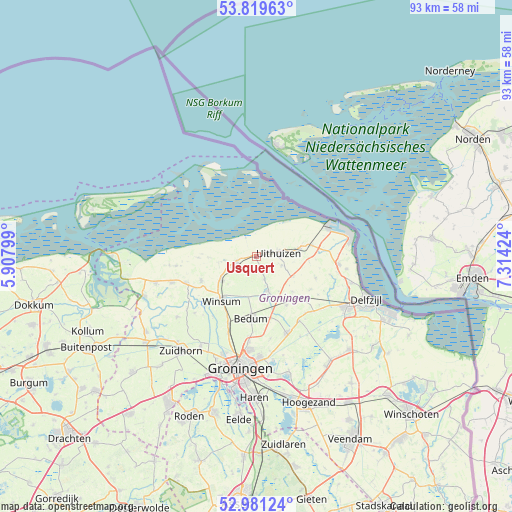
Usquert GPS coordinates[2]
53° 24' 9" North, 6° 36' 39.996" East
| Map corner | latitude | longitude |
|---|---|---|
| Upper-left | 53.81963°, | 5.90799° |
| Center: | 53.4025°, | 6.61111° |
| Lower-right: | 52.98124°, | 7.31424° |
| Map W x H: | 93.2×93.2 km | = 57.9×57.9mi |
| max Lat: | 53.48025° ⇑0.4% North |
| Usquert: | 53.4025° |
| min Lat: | ⇓99.6% South 50.76917° |
| min Long | Usquert | max Long |
| 3.38611° | 6.61111° | 7.16528° |
| W 91.6%⇐ | ⇒8.4% E |
Elevation
Elevation of Usquert is 4 m = 13 ft, and this is 11 m = 36 ft below average elevation for this country.
| Max E: |
203 m = 666 ft | 58.8% |
| Avg. | 15 m = 49 ft | |
| Usquert | 4 m = 13 ft | |
Min E: |
-6 m = -20 ft | 41.2% |
See also: Netherlands elevation on elevation.city.
Geographical zone
Usquert is located in North temperate zone (between Tropic of Cancer and the Arctic Circle). Distance of this North polar circle is 1463.4 km =909.3 mi to North.| Distance of | km | miles | from Usquert |
|---|---|---|---|
| North Pole | 4069.3 | 2528.5 | to North |
| Arctic Circle | 1463.4 | 909.3 | to North |
| Tropic Cancer | 3331.9 | 2070.3 | to South |
| Equator | 5937.8 | 3689.6 | to South |


Nearby cities:
15 places around Usquert: (largest is in red/bold)
• Baflo
7.8 km =4.8 mi,  235°
235°
• Bedum
11.3 km =7 mi,  182°
182°
• Eenrum
11.1 km =6.9 mi,  246°
246°
• Kantens
4.4 km =2.7 mi,  158°
158°
• Loppersum
12 km =7.5 mi,  131°
131°
• Middelstum
6.5 km =4 mi, 161°
• Obergum
9.9 km =6.2 mi,  219°
219°
• Onderdendam
7.7 km =4.8 mi,  190°
190°
• Roodeschool
10.5 km =6.5 mi,  78°
78°
• Sauwerd
13.2 km =8.2 mi,  202°
202°
• Stedum
10.5 km =6.5 mi,  147°
147°
• Uithuizen
4 km =2.5 mi, 82°
• Uithuizermeeden
7.6 km =4.7 mi, 80°
• Warffum
3.7 km =2.3 mi, 252°
• Winsum
10 km =6.2 mi, 216°
Sources, notices
• [Note1] Compared only with cities in Netherlands existing in our database
• [Src1] Map data: © OpenStreetMap contributors (CC-BY-SA)
• [Src2] Other city data from geonames.org with taken over terms of usage.
• [Src3] Geographical zone / Annual Mean Temperature by Robert A. Rohde @ Wikipedia
