Eenrum geodata
Eenrum (Groningen) is a populated place; located in Netherlands in Europe/Amsterdam (GMT+2) time zone. With population of 1,365 people, there are 1202 cities with bigger population in this country. Compared to other cities in Netherlands, 99% of cities are located further ↓South; 88.1% of cities are located further ←West and 83.9% of cities have higher elevation than Eenrum. Note1


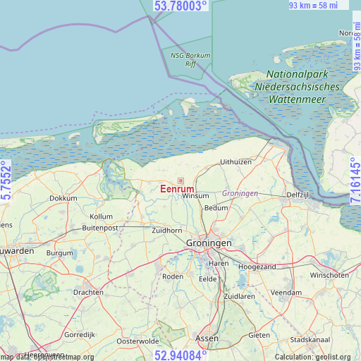
Eenrum GPS coordinates[2]
53° 21' 45" North, 6° 27' 29.988" East
| Map corner | latitude | longitude |
|---|---|---|
| Upper-left | 53.78003°, | 5.7552° |
| Center: | 53.3625°, | 6.45833° |
| Lower-right: | 52.94084°, | 7.16145° |
| Map W x H: | 93.3×93.3 km | = 58×58mi |
| max Lat: | 53.48025° ⇑1% North |
| Eenrum: | 53.3625° |
| min Lat: | ⇓99% South 50.76917° |
| min Long | Eenrum | max Long |
| 3.38611° | 6.45833° | 7.16528° |
| W 88.1%⇐ | ⇒11.9% E |
Elevation
Elevation of Eenrum is 1 m = 3 ft, and this is 14 m = 46 ft below average elevation for this country.
| Max E: |
203 m = 666 ft | 83.9% |
| Avg. | 15 m = 49 ft | |
| Eenrum | 1 m = 3 ft | |
Min E: |
-6 m = -20 ft | 16.1% |
See also: Netherlands elevation on elevation.city.
Geographical zone
Eenrum is located in North temperate zone (between Tropic of Cancer and the Arctic Circle). Distance of this North polar circle is 1467.8 km =912 mi to North.| Distance of | km | miles | from Eenrum |
|---|---|---|---|
| North Pole | 4073.7 | 2531.3 | to North |
| Arctic Circle | 1467.8 | 912 | to North |
| Tropic Cancer | 3327.4 | 2067.5 | to South |
| Equator | 5933.4 | 3686.8 | to South |


Nearby cities:
15 places around Eenrum: (largest is in red/bold)
• Adorp
10.9 km =6.8 mi,  152°
152°
• Baflo
3.7 km =2.3 mi,  90°
90°
• Ezinge
5.9 km =3.7 mi,  190°
190°
• Kantens
11.7 km =7.3 mi, 88°
• Kloosterburen
5.2 km =3.2 mi,  301°
301°
• Leens
5.3 km =3.3 mi,  266°
266°
• Obergum
5.1 km =3.2 mi,  129°
129°
• Oldehove
7.8 km =4.8 mi,  212°
212°
• Onderdendam
9.3 km =5.8 mi,  109°
109°
• Sauwerd
9.2 km =5.7 mi, 146°
• Ulrum
8.3 km =5.2 mi, 267°
• Usquert
11.1 km =6.9 mi,  66°
66°
• Warffum
7.4 km =4.6 mi,  63°
63°
• Winsum
5.5 km =3.4 mi, 131°
• Zoutkamp
10.6 km =6.6 mi,  255°
255°
Sources, notices
• [Note1] Compared only with cities in Netherlands existing in our database
• [Src1] Map data: © OpenStreetMap contributors (CC-BY-SA)
• [Src2] Other city data from geonames.org with taken over terms of usage.
• [Src3] Geographical zone / Annual Mean Temperature by Robert A. Rohde @ Wikipedia
