Sloten geodata
Sloten (Friesland) is a populated place; located in Netherlands in Europe/Amsterdam (GMT+2) time zone. With population of 735 people, there are 1580 cities with bigger population in this country. Compared to other cities in Netherlands, 82.5% of cities are located further ↓South; 50.4% of cities are located further →East and 54.1% of cities have higher elevation than Sloten. Note1


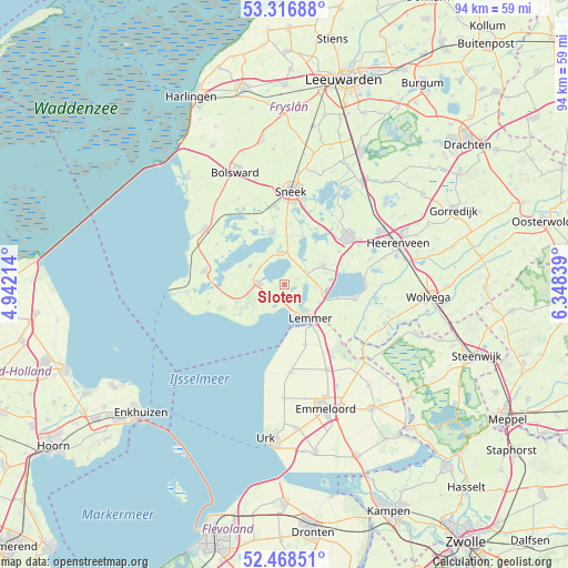
Sloten GPS coordinates[2]
52° 53' 41.172" North, 5° 38' 42.936" East
| Map corner | latitude | longitude |
|---|---|---|
| Upper-left | 53.31688°, | 4.94214° |
| Center: | 52.89477°, | 5.64526° |
| Lower-right: | 52.46851°, | 6.34839° |
| Map W x H: | 94.3×94.3 km | = 58.6×58.6mi |
| max Lat: | 53.48025° ⇑17.5% North |
| Sloten: | 52.89477° |
| min Lat: | ⇓82.5% South 50.76917° |
| min Long | Sloten | max Long |
| 3.38611° | 5.64526° | 7.16528° |
| W 49.6%⇐ | ⇒50.4% E |
Elevation
Elevation of Sloten is 5 m = 16 ft, and this is 10 m = 33 ft below average elevation for this country.
| Max E: |
203 m = 666 ft | 54.1% |
| Avg. | 15 m = 49 ft | |
| Sloten | 5 m = 16 ft | |
Min E: |
-6 m = -20 ft | 45.9% |
See also: Netherlands elevation on elevation.city.
Geographical zone
Sloten is located in North temperate zone (between Tropic of Cancer and the Arctic Circle). Distance of this North polar circle is 1519.8 km =944.4 mi to North.| Distance of | km | miles | from Sloten |
|---|---|---|---|
| North Pole | 4125.7 | 2563.6 | to North |
| Arctic Circle | 1519.8 | 944.4 | to North |
| Tropic Cancer | 3275.4 | 2035.2 | to South |
| Equator | 5881.3 | 3654.5 | to South |


Nearby cities:
15 places around Sloten: (largest is in red/bold)
• Bakhuizen
12.8 km =8 mi,  257°
257°
• Balk
4.4 km =2.7 mi,  274°
274°
• Bantega
11.7 km =7.3 mi,  120°
120°
• Echtenerbrug
12.1 km =7.5 mi,  102°
102°
• Heeg
8.5 km =5.3 mi,  344°
344°
• Hommerts
9.5 km =5.9 mi,  1°
1°
• Langweer
8.7 km =5.4 mi,  35°
35°
• Lemmer
6.9 km =4.3 mi,  141°
141°
• Nijemirdum
6.7 km =4.2 mi,  230°
230°
• Oudega
12.6 km =7.8 mi,  329°
329°
• Oudemirdum
8.9 km =5.5 mi,  236°
236°
• Scharsterbrug
10.5 km =6.5 mi,  58°
58°
• Sint Nicolaasga
7.2 km =4.5 mi, 64°
• Wijckel
1.7 km =1.1 mi, 244°
• Woudsend
5.5 km =3.4 mi,  348°
348°
Sources, notices
• [Note1] Compared only with cities in Netherlands existing in our database
• [Src1] Map data: © OpenStreetMap contributors (CC-BY-SA)
• [Src2] Other city data from geonames.org with taken over terms of usage.
• [Src3] Geographical zone / Annual Mean Temperature by Robert A. Rohde @ Wikipedia
