Echtenerbrug geodata
Echtenerbrug (Friesland) is a populated place; located in Netherlands in Europe/Amsterdam (GMT+2) time zone. With population of 1,200 people, there are 1287 cities with bigger population in this country. Compared to other cities in Netherlands, 81.8% of cities are located further ↓South; 59.2% of cities are located further ←West and 91.3% of cities have higher elevation than Echtenerbrug. Note1


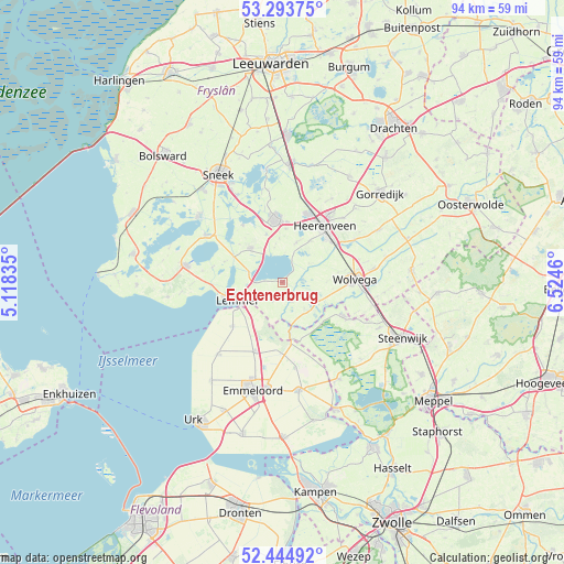
Echtenerbrug GPS coordinates[2]
52° 52' 17.076" North, 5° 49' 17.292" East
| Map corner | latitude | longitude |
|---|---|---|
| Upper-left | 53.29375°, | 5.11835° |
| Center: | 52.87141°, | 5.82147° |
| Lower-right: | 52.44492°, | 6.5246° |
| Map W x H: | 94.4×94.4 km | = 58.7×58.7mi |
| max Lat: | 53.48025° ⇑18.2% North |
| Echtenerbrug: | 52.87141° |
| min Lat: | ⇓81.8% South 50.76917° |
| min Long | Echtenerbrug | max Long |
| 3.38611° | 5.82147° | 7.16528° |
| W 59.2%⇐ | ⇒40.8% E |
Elevation
Elevation of Echtenerbrug is 0 m = 0 ft, and this is 15 m = 49 ft below average elevation for this country.
| Max E: |
203 m = 666 ft | 91.3% |
| Avg. | 15 m = 49 ft | |
| Echtenerbrug | 0 m = 0 ft | |
Min E: |
-6 m = -20 ft | 8.7% |
See also: Netherlands elevation on elevation.city.
Geographical zone
Echtenerbrug is located in North temperate zone (between Tropic of Cancer and the Arctic Circle). Distance of this North polar circle is 1522.4 km =946 mi to North.| Distance of | km | miles | from Echtenerbrug |
|---|---|---|---|
| North Pole | 4128.3 | 2565.2 | to North |
| Arctic Circle | 1522.4 | 946 | to North |
| Tropic Cancer | 3272.8 | 2033.6 | to South |
| Equator | 5878.7 | 3652.9 | to South |


Nearby cities:
15 places around Echtenerbrug: (largest is in red/bold)
• Bantega
3.7 km =2.3 mi,  207°
207°
• De Greiden
10.7 km =6.6 mi,  35°
35°
• Haskerhorne
9.1 km =5.7 mi,  3°
3°
• Heerenveen
11.7 km =7.3 mi,  33°
33°
• Joure
10.6 km =6.6 mi,  353°
353°
• Kuinre
9.4 km =5.8 mi,  172°
172°
• Lemmer
8 km =5 mi,  249°
249°
• Oldemarkt
11.7 km =7.3 mi,  118°
118°
• Oudehaske
10.1 km =6.3 mi,  19°
19°
• Oudeschoot
11.3 km =7 mi,  52°
52°
• Rotsterhaule
5.7 km =3.5 mi, 20°
• Rottum
8.7 km =5.4 mi, 34°
• Scharsterbrug
8.6 km =5.3 mi,  340°
340°
• Sint Nicolaasga
7.8 km =4.8 mi,  317°
317°
• Sintjohannesga
7.1 km =4.4 mi, 19°
Sources, notices
• [Note1] Compared only with cities in Netherlands existing in our database
• [Src1] Map data: © OpenStreetMap contributors (CC-BY-SA)
• [Src2] Other city data from geonames.org with taken over terms of usage.
• [Src3] Geographical zone / Annual Mean Temperature by Robert A. Rohde @ Wikipedia
