Schalkhaar geodata
Schalkhaar (Overijssel) is a populated place; located in Netherlands in Europe/Amsterdam (GMT+2) time zone. With population of 4,610 people, there are 522 cities with bigger population in this country. Compared to other cities in Netherlands, 65.2% of cities are located further ↓South; 82.9% of cities are located further ←West and 57.3% of cities have lower elevation than Schalkhaar. Note1


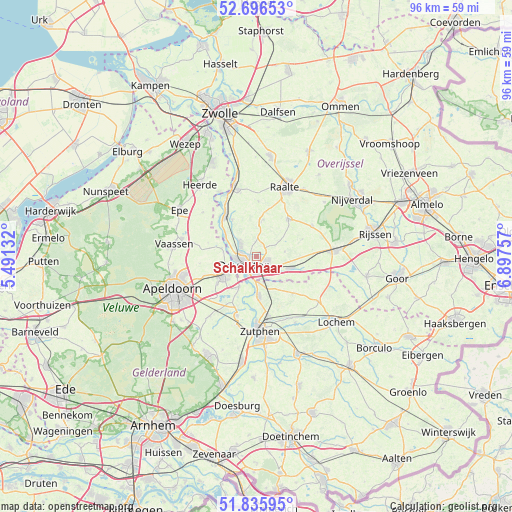
Schalkhaar GPS coordinates[2]
52° 16' 5.988" North, 6° 11' 39.984" East
| Map corner | latitude | longitude |
|---|---|---|
| Upper-left | 52.69653°, | 5.49132° |
| Center: | 52.26833°, | 6.19444° |
| Lower-right: | 51.83595°, | 6.89757° |
| Map W x H: | 95.7×95.7 km | = 59.5×59.5mi |
| max Lat: | 53.48025° ⇑34.8% North |
| Schalkhaar: | 52.26833° |
| min Lat: | ⇓65.2% South 50.76917° |
| min Long | Schalkhaar | max Long |
| 3.38611° | 6.19444° | 7.16528° |
| W 82.9%⇐ | ⇒17.1% E |
Elevation
Elevation of Schalkhaar is 9 m = 30 ft, and this is 6 m = 20 ft below average elevation for this country.
| Max E: |
203 m = 666 ft | 42.7% |
| Avg. | 15 m = 49 ft | |
| Schalkhaar | 9 m = 30 ft | |
Min E: |
-6 m = -20 ft | 57.3% |
See also: Netherlands elevation on elevation.city.
Geographical zone
Schalkhaar is located in North temperate zone (between Tropic of Cancer and the Arctic Circle). Distance of this North polar circle is 1589.5 km =987.7 mi to North.| Distance of | km | miles | from Schalkhaar |
|---|---|---|---|
| North Pole | 4195.4 | 2606.9 | to North |
| Arctic Circle | 1589.5 | 987.7 | to North |
| Tropic Cancer | 3205.8 | 1992 | to South |
| Equator | 5811.7 | 3611.2 | to South |


Nearby cities:
15 places around Schalkhaar: (largest is in red/bold)
• Borgele
3.2 km =2 mi,  286°
286°
• Boskamp
8.3 km =5.2 mi,  326°
326°
• De Hoven
4.1 km =2.5 mi,  238°
238°
• Deventer
2.6 km =1.6 mi,  234°
234°
• Eefde
11.5 km =7.1 mi,  169°
169°
• Epse
4.8 km =3 mi,  175°
175°
• Gorssel
7.4 km =4.6 mi, 176°
• Harfsen
9.7 km =6 mi,  134°
134°
• Het Oostrik
2.5 km =1.6 mi,  143°
143°
• Loo
10 km =6.2 mi,  100°
100°
• Olst
9.6 km =6 mi,  323°
323°
• Terwolde
6.6 km =4.1 mi,  284°
284°
• Twello
7.2 km =4.5 mi, 240°
• Welsum
10.3 km =6.4 mi, 317°
• Wilp
6.3 km =3.9 mi,  208°
208°
Sources, notices
• [Note1] Compared only with cities in Netherlands existing in our database
• [Src1] Map data: © OpenStreetMap contributors (CC-BY-SA)
• [Src2] Other city data from geonames.org with taken over terms of usage.
• [Src3] Geographical zone / Annual Mean Temperature by Robert A. Rohde @ Wikipedia
