Boskamp geodata
Boskamp (Overijssel) is a populated place; located in Netherlands in Europe/Amsterdam (GMT+2) time zone. With population of 1,150 people, there are 1305 cities with bigger population in this country. Compared to other cities in Netherlands, 67.3% of cities are located further ↓South; 80.6% of cities are located further ←West and 58.8% of cities have higher elevation than Boskamp. Note1


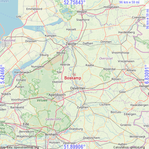
Boskamp GPS coordinates[2]
52° 19' 50.988" North, 6° 7' 40.008" East
| Map corner | latitude | longitude |
|---|---|---|
| Upper-left | 52.75843°, | 5.42466° |
| Center: | 52.33083°, | 6.12778° |
| Lower-right: | 51.89906°, | 6.83091° |
| Map W x H: | 95.6×95.6 km | = 59.4×59.4mi |
| max Lat: | 53.48025° ⇑32.7% North |
| Boskamp: | 52.33083° |
| min Lat: | ⇓67.3% South 50.76917° |
| min Long | Boskamp | max Long |
| 3.38611° | 6.12778° | 7.16528° |
| W 80.6%⇐ | ⇒19.4% E |
Elevation
Elevation of Boskamp is 4 m = 13 ft, and this is 11 m = 36 ft below average elevation for this country.
| Max E: |
203 m = 666 ft | 58.8% |
| Avg. | 15 m = 49 ft | |
| Boskamp | 4 m = 13 ft | |
Min E: |
-6 m = -20 ft | 41.2% |
See also: Netherlands elevation on elevation.city.
Geographical zone
Boskamp is located in North temperate zone (between Tropic of Cancer and the Arctic Circle). Distance of this North polar circle is 1582.5 km =983.3 mi to North.| Distance of | km | miles | from Boskamp |
|---|---|---|---|
| North Pole | 4188.4 | 2602.6 | to North |
| Arctic Circle | 1582.5 | 983.3 | to North |
| Tropic Cancer | 3212.7 | 1996.3 | to South |
| Equator | 5818.6 | 3615.5 | to South |


Nearby cities:
15 places around Boskamp: (largest is in red/bold)
• Borgele
6.2 km =3.9 mi,  166°
166°
• De Hoven
9.2 km =5.7 mi, 173°
• Deventer
8.8 km =5.5 mi,  163°
163°
• Elshof
8.5 km =5.3 mi,  35°
35°
• Emst
10.6 km =6.6 mi,  260°
260°
• Epe
10 km =6.2 mi,  280°
280°
• Heerde
8.6 km =5.3 mi,  316°
316°
• Het Oostrik
10.8 km =6.7 mi,  146°
146°
• Oene
5.6 km =3.5 mi,  285°
285°
• Olst
1.4 km =0.9 mi,  301°
301°
• Schalkhaar
8.3 km =5.2 mi, 146°
• Terwolde
5.6 km =3.5 mi,  199°
199°
• Twello
10.6 km =6.6 mi,  189°
189°
• Welsum
2.5 km =1.6 mi, 282°
• Wijhe
6.2 km =3.9 mi,  4°
4°
Sources, notices
• [Note1] Compared only with cities in Netherlands existing in our database
• [Src1] Map data: © OpenStreetMap contributors (CC-BY-SA)
• [Src2] Other city data from geonames.org with taken over terms of usage.
• [Src3] Geographical zone / Annual Mean Temperature by Robert A. Rohde @ Wikipedia
