Rottevalle geodata
Rottevalle (Friesland) is a populated place; located in Netherlands in Europe/Amsterdam (GMT+2) time zone. With population of 1,355 people, there are 1208 cities with bigger population in this country. Compared to other cities in Netherlands, 90.3% of cities are located further ↓South; 79.7% of cities are located further ←West and 83.9% of cities have higher elevation than Rottevalle. Note1


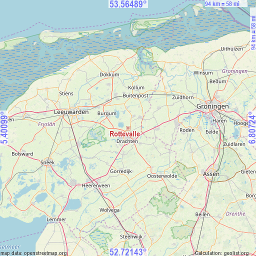
Rottevalle GPS coordinates[2]
53° 8' 42.828" North, 6° 6' 14.796" East
| Map corner | latitude | longitude |
|---|---|---|
| Upper-left | 53.56489°, | 5.40099° |
| Center: | 53.14523°, | 6.10411° |
| Lower-right: | 52.72143°, | 6.80724° |
| Map W x H: | 93.8×93.8 km | = 58.3×58.3mi |
| max Lat: | 53.48025° ⇑9.7% North |
| Rottevalle: | 53.14523° |
| min Lat: | ⇓90.3% South 50.76917° |
| min Long | Rottevalle | max Long |
| 3.38611° | 6.10411° | 7.16528° |
| W 79.7%⇐ | ⇒20.3% E |
Elevation
Elevation of Rottevalle is 1 m = 3 ft, and this is 14 m = 46 ft below average elevation for this country.
| Max E: |
203 m = 666 ft | 83.9% |
| Avg. | 15 m = 49 ft | |
| Rottevalle | 1 m = 3 ft | |
Min E: |
-6 m = -20 ft | 16.1% |
See also: Netherlands elevation on elevation.city.
Geographical zone
Rottevalle is located in North temperate zone (between Tropic of Cancer and the Arctic Circle). Distance of this North polar circle is 1492 km =927.1 mi to North.| Distance of | km | miles | from Rottevalle |
|---|---|---|---|
| North Pole | 4097.9 | 2546.3 | to North |
| Arctic Circle | 1492 | 927.1 | to North |
| Tropic Cancer | 3303.3 | 2052.6 | to South |
| Equator | 5909.2 | 3671.8 | to South |


Nearby cities:
15 places around Rottevalle: (largest is in red/bold)
• Boelenslaan
3.3 km =2.1 mi,  55°
55°
• De Drait
5.8 km =3.6 mi,  204°
204°
• De Wilgen
6.9 km =4.3 mi,  222°
222°
• Drachten
3.7 km =2.3 mi,  185°
185°
• Drachtstercompagnie
2.8 km =1.7 mi,  115°
115°
• Drogeham
6.3 km =3.9 mi,  4°
4°
• Eastermar
4.4 km =2.7 mi,  318°
318°
• Harkema
4.7 km =2.9 mi,  24°
24°
• Houtigehage
2.8 km =1.7 mi,  74°
74°
• Jistrum
7.8 km =4.8 mi,  341°
341°
• Kootstertille
7.5 km =4.7 mi,  353°
353°
• Opeinde
3.4 km =2.1 mi,  248°
248°
• Oudega
7.4 km =4.6 mi, 252°
• Surhuisterveen
6.2 km =3.9 mi,  45°
45°
• Ureterp
7.2 km =4.5 mi,  144°
144°
Sources, notices
• [Note1] Compared only with cities in Netherlands existing in our database
• [Src1] Map data: © OpenStreetMap contributors (CC-BY-SA)
• [Src2] Other city data from geonames.org with taken over terms of usage.
• [Src3] Geographical zone / Annual Mean Temperature by Robert A. Rohde @ Wikipedia
