Ureterp geodata
Ureterp (Friesland) is a populated place; located in Netherlands in Europe/Amsterdam (GMT+2) time zone. With population of 3,810 people, there are 619 cities with bigger population in this country. Compared to other cities in Netherlands, 88.6% of cities are located further ↓South; 82.4% of cities are located further ←West and 65.8% of cities have higher elevation than Ureterp. Note1


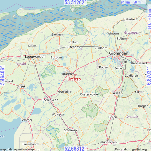
Ureterp GPS coordinates[2]
53° 5' 32.784" North, 6° 10' 1.848" East
| Map corner | latitude | longitude |
|---|---|---|
| Upper-left | 53.51262°, | 5.46406° |
| Center: | 53.09244°, | 6.16718° |
| Lower-right: | 52.66812°, | 6.87031° |
| Map W x H: | 93.9×93.9 km | = 58.3×58.3mi |
| max Lat: | 53.48025° ⇑11.4% North |
| Ureterp: | 53.09244° |
| min Lat: | ⇓88.6% South 50.76917° |
| min Long | Ureterp | max Long |
| 3.38611° | 6.16718° | 7.16528° |
| W 82.4%⇐ | ⇒17.6% E |
Elevation
Elevation of Ureterp is 3 m = 10 ft, and this is 12 m = 39 ft below average elevation for this country.
| Max E: |
203 m = 666 ft | 65.8% |
| Avg. | 15 m = 49 ft | |
| Ureterp | 3 m = 10 ft | |
Min E: |
-6 m = -20 ft | 34.2% |
See also: Netherlands elevation on elevation.city.
Geographical zone
Ureterp is located in North temperate zone (between Tropic of Cancer and the Arctic Circle). Distance of this North polar circle is 1497.8 km =930.7 mi to North.| Distance of | km | miles | from Ureterp |
|---|---|---|---|
| North Pole | 4103.7 | 2549.9 | to North |
| Arctic Circle | 1497.8 | 930.7 | to North |
| Tropic Cancer | 3297.4 | 2048.9 | to South |
| Equator | 5903.3 | 3668.1 | to South |


Nearby cities:
15 places around Ureterp: (largest is in red/bold)
• Bakkeveen
6.1 km =3.8 mi,  102°
102°
• Beetsterzwaag
7.1 km =4.4 mi,  238°
238°
• Boelenslaan
7.8 km =4.8 mi,  349°
349°
• Boornbergum
8.2 km =5.1 mi,  262°
262°
• De Drait
6.7 km =4.2 mi,  274°
274°
• Drachten
5.1 km =3.2 mi,  296°
296°
• Drachtstercompagnie
5 km =3.1 mi,  339°
339°
• Frieschepalen
3.2 km =2 mi,  54°
54°
• Houtigehage
6.8 km =4.2 mi, 347°
• Marum
8.6 km =5.3 mi, 47°
• Opeinde
8.7 km =5.4 mi, 302°
• Rottevalle
7.2 km =4.5 mi,  324°
324°
• Siegerswoude
5.2 km =3.2 mi,  81°
81°
• Waskemeer
8.5 km =5.3 mi,  117°
117°
• Wijnjewoude
4.6 km =2.9 mi,  146°
146°
Sources, notices
• [Note1] Compared only with cities in Netherlands existing in our database
• [Src1] Map data: © OpenStreetMap contributors (CC-BY-SA)
• [Src2] Other city data from geonames.org with taken over terms of usage.
• [Src3] Geographical zone / Annual Mean Temperature by Robert A. Rohde @ Wikipedia
