Randwijk geodata
Randwijk (Gelderland) is a populated place; located in Netherlands in Europe/Amsterdam (GMT+2) time zone. With population of 935 people, there are 1439 cities with bigger population in this country. Compared to other cities in Netherlands, 54.2% of cities are located further ↑North; 52.2% of cities are located further ←West and 57.3% of cities have lower elevation than Randwijk. Note1


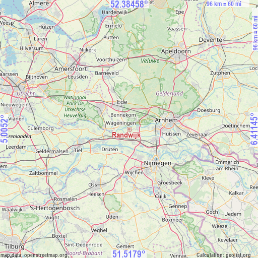
Randwijk GPS coordinates[2]
51° 57' 11.988" North, 5° 42' 29.988" East
| Map corner | latitude | longitude |
|---|---|---|
| Upper-left | 52.38458°, | 5.0052° |
| Center: | 51.95333°, | 5.70833° |
| Lower-right: | 51.5179°, | 6.41145° |
| Map W x H: | 96.4×96.4 km | = 59.9×59.9mi |
| max Lat: | 53.48025° ⇑54.2% North |
| Randwijk: | 51.95333° |
| min Lat: | ⇓45.8% South 50.76917° |
| min Long | Randwijk | max Long |
| 3.38611° | 5.70833° | 7.16528° |
| W 52.2%⇐ | ⇒47.8% E |
Elevation
Elevation of Randwijk is 9 m = 30 ft, and this is 6 m = 20 ft below average elevation for this country.
| Max E: |
203 m = 666 ft | 42.7% |
| Avg. | 15 m = 49 ft | |
| Randwijk | 9 m = 30 ft | |
Min E: |
-6 m = -20 ft | 57.3% |
See also: Netherlands elevation on elevation.city.
Geographical zone
Randwijk is located in North temperate zone (between Tropic of Cancer and the Arctic Circle). Distance of this North polar circle is 1624.5 km =1009.4 mi to North.| Distance of | km | miles | from Randwijk |
|---|---|---|---|
| North Pole | 4230.4 | 2628.6 | to North |
| Arctic Circle | 1624.5 | 1009.4 | to North |
| Tropic Cancer | 3170.7 | 1970.2 | to South |
| Equator | 5776.7 | 3589.5 | to South |


Nearby cities:
15 places around Randwijk: (largest is in red/bold)
• Achterberg
8.5 km =5.3 mi,  284°
284°
• Andelst
5.2 km =3.2 mi,  164°
164°
• Bennekom
5.5 km =3.4 mi,  336°
336°
• Deest
7.6 km =4.7 mi,  202°
202°
• Doorwerth
6.7 km =4.2 mi,  64°
64°
• Driel
7.3 km =4.5 mi,  84°
84°
• Heelsum
4.8 km =3 mi,  44°
44°
• Heteren
3.3 km =2.1 mi, 83°
• Heveadorp
7.5 km =4.7 mi,  71°
71°
• Opheusden
5.8 km =3.6 mi,  245°
245°
• Renkum
3.1 km =1.9 mi,  33°
33°
• Valburg
7.3 km =4.5 mi,  129°
129°
• Wageningen
3.4 km =2.1 mi,  302°
302°
• Wolfheze
7.9 km =4.9 mi,  45°
45°
• Zetten
2.8 km =1.7 mi,  172°
172°
Sources, notices
• [Note1] Compared only with cities in Netherlands existing in our database
• [Src1] Map data: © OpenStreetMap contributors (CC-BY-SA)
• [Src2] Other city data from geonames.org with taken over terms of usage.
• [Src3] Geographical zone / Annual Mean Temperature by Robert A. Rohde @ Wikipedia
