Heelsum geodata
Heelsum (Gelderland) is a populated place; located in Netherlands in Europe/Amsterdam (GMT+2) time zone. With population of 3,175 people, there are 727 cities with bigger population in this country. Compared to other cities in Netherlands, 52.2% of cities are located further ↑North; 54.9% of cities are located further ←West and 87.8% of cities have lower elevation than Heelsum. Note1


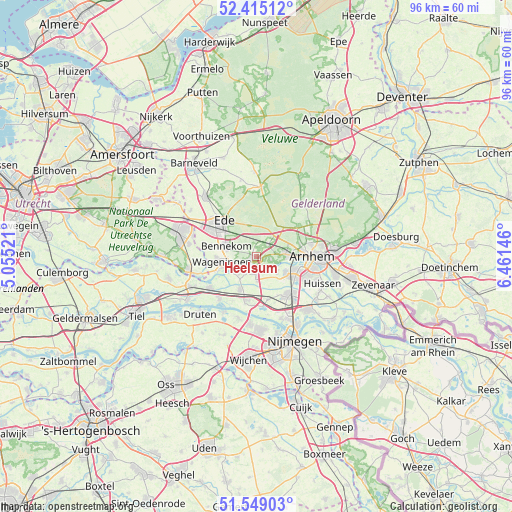
Heelsum GPS coordinates[2]
51° 59' 3.012" North, 5° 45' 29.988" East
| Map corner | latitude | longitude |
|---|---|---|
| Upper-left | 52.41512°, | 5.05521° |
| Center: | 51.98417°, | 5.75833° |
| Lower-right: | 51.54903°, | 6.46146° |
| Map W x H: | 96.3×96.3 km | = 59.8×59.8mi |
| max Lat: | 53.48025° ⇑52.2% North |
| Heelsum: | 51.98417° |
| min Lat: | ⇓47.8% South 50.76917° |
| min Long | Heelsum | max Long |
| 3.38611° | 5.75833° | 7.16528° |
| W 54.9%⇐ | ⇒45.1% E |
Elevation
Elevation of Heelsum is 30 m = 98 ft, and this is 15 m = 49 ft above average elevation for this country.
| Max E: |
203 m = 666 ft | 12.2% |
| Heelsum | 30 m 98 ft | |
| Avg. | 15 m = 49 ft | |
Min E: |
-6 m = -20 ft | 87.8% |
See also: Netherlands elevation on elevation.city.
Geographical zone
Heelsum is located in North temperate zone (between Tropic of Cancer and the Arctic Circle). Distance of this North polar circle is 1621.1 km =1007.3 mi to North.| Distance of | km | miles | from Heelsum |
|---|---|---|---|
| North Pole | 4227 | 2626.5 | to North |
| Arctic Circle | 1621.1 | 1007.3 | to North |
| Tropic Cancer | 3174.2 | 1972.4 | to South |
| Equator | 5780.1 | 3591.6 | to South |


Nearby cities:
15 places around Heelsum: (largest is in red/bold)
• Bakenberg
8.5 km =5.3 mi,  74°
74°
• Bennekom
5.8 km =3.6 mi,  285°
285°
• Doorwerth
2.7 km =1.7 mi,  101°
101°
• Driel
4.7 km =2.9 mi,  126°
126°
• Heteren
3.1 km =1.9 mi,  183°
183°
• Heveadorp
3.8 km =2.4 mi,  105°
105°
• Hoogkamp
8.5 km =5.3 mi,  80°
80°
• Oosterbeek
6 km =3.7 mi,  88°
88°
• Randwijk
4.8 km =3 mi,  224°
224°
• Renkum
1.9 km =1.2 mi,  244°
244°
• Sterrenberg
8.7 km =5.4 mi, 83°
• Valburg
8.4 km =5.2 mi,  164°
164°
• Wageningen
6.5 km =4 mi,  255°
255°
• Wolfheze
3.1 km =1.9 mi,  45°
45°
• Zetten
6.9 km =4.3 mi,  206°
206°
Sources, notices
• [Note1] Compared only with cities in Netherlands existing in our database
• [Src1] Map data: © OpenStreetMap contributors (CC-BY-SA)
• [Src2] Other city data from geonames.org with taken over terms of usage.
• [Src3] Geographical zone / Annual Mean Temperature by Robert A. Rohde @ Wikipedia
