Oud-Caberg geodata
Oud-Caberg (Limburg) is a section of populated place; located in Netherlands in Europe/Amsterdam (GMT+2) time zone. With population of 1,890 people, there are 999 cities with bigger population in this country. Compared to other cities in Netherlands, 97.6% of cities are located further ↑North; 50.5% of cities are located further ←West and 94.4% of cities have lower elevation than Oud-Caberg. Note1


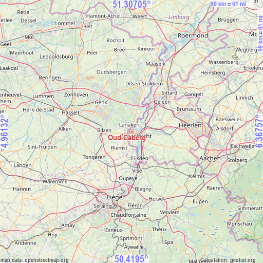
Oud-Caberg GPS coordinates[2]
50° 51' 55.404" North, 5° 39' 51.984" East
| Map corner | latitude | longitude |
|---|---|---|
| Upper-left | 51.30705°, | 4.96132° |
| Center: | 50.86539°, | 5.66444° |
| Lower-right: | 50.4195°, | 6.36757° |
| Map W x H: | 98.7×98.7 km | = 61.3×61.3mi |
| max Lat: | 53.48025° ⇑97.6% North |
| Oud-Caberg: | 50.86539° |
| min Lat: | ⇓2.4% South 50.76917° |
| min Long | Oud-Caberg | max Long |
| 3.38611° | 5.66444° | 7.16528° |
| W 50.5%⇐ | ⇒49.5% E |
Elevation
Elevation of Oud-Caberg is 61 m = 200 ft, and this is 46 m = 151 ft above average elevation for this country.
| Max E: |
203 m = 666 ft | 5.6% |
| Oud-Caberg | 61 m 200 ft | |
| Avg. | 15 m = 49 ft | |
Min E: |
-6 m = -20 ft | 94.4% |
See also: Netherlands elevation on elevation.city.
Geographical zone
Oud-Caberg is located in North temperate zone (between Tropic of Cancer and the Arctic Circle). Distance of this North polar circle is 1745.5 km =1084.6 mi to North.| Distance of | km | miles | from Oud-Caberg |
|---|---|---|---|
| North Pole | 4351.4 | 2703.8 | to North |
| Arctic Circle | 1745.5 | 1084.6 | to North |
| Tropic Cancer | 3049.8 | 1895.1 | to South |
| Equator | 5655.7 | 3514.3 | to South |


Nearby cities:
15 places around Oud-Caberg: (largest is in red/bold)
• Amby
4.8 km =3 mi,  94°
94°
• Belfort
2.1 km =1.3 mi,  188°
188°
• Biesland
2.8 km =1.7 mi,  163°
163°
• Borgharen
2.1 km =1.3 mi,  50°
50°
• Bunde
5.9 km =3.7 mi, 53°
• Heer
5.5 km =3.4 mi,  123°
123°
• Heugem
5.2 km =3.2 mi,  143°
143°
• Itteren
4.5 km =2.8 mi,  36°
36°
• Limmel
3 km =1.9 mi, 86°
• Maastricht
2.6 km =1.6 mi, 137°
• Malberg
0.8 km =0.5 mi,  245°
245°
• Pottenberg
1.7 km =1.1 mi,  199°
199°
• Rothem
5.4 km =3.4 mi,  76°
76°
• Scharn
5.1 km =3.2 mi,  109°
109°
• Wolder
3.1 km =1.9 mi, 186°
Sources, notices
• [Note1] Compared only with cities in Netherlands existing in our database
• [Src1] Map data: © OpenStreetMap contributors (CC-BY-SA)
• [Src2] Other city data from geonames.org with taken over terms of usage.
• [Src3] Geographical zone / Annual Mean Temperature by Robert A. Rohde @ Wikipedia
