Ommoord geodata
Ommoord (South Holland) is a section of populated place; located in Netherlands in Europe/Amsterdam (GMT+2) time zone. With population of 25,150 people, there are 135 cities with bigger population in this country. Compared to other cities in Netherlands, 53.6% of cities are located further ↑North; 87.8% of cities are located further →East and 98.2% of cities have higher elevation than Ommoord. Note1


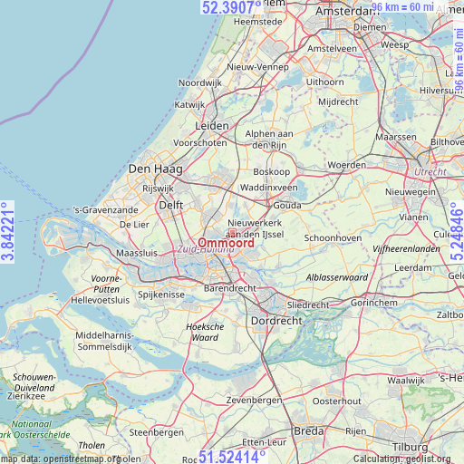
Ommoord GPS coordinates[2]
51° 57' 34.236" North, 4° 32' 43.188" East
| Map corner | latitude | longitude |
|---|---|---|
| Upper-left | 52.3907°, | 3.84221° |
| Center: | 51.95951°, | 4.54533° |
| Lower-right: | 51.52414°, | 5.24846° |
| Map W x H: | 96.4×96.4 km | = 59.9×59.9mi |
| max Lat: | 53.48025° ⇑53.6% North |
| Ommoord: | 51.95951° |
| min Lat: | ⇓46.4% South 50.76917° |
| min Long | Ommoord | max Long |
| 3.38611° | 4.54533° | 7.16528° |
| W 12.2%⇐ | ⇒87.8% E |
Elevation
Elevation of Ommoord is -2 m = -7 ft, and this is 17 m = 56 ft below average elevation for this country.
| Max E: |
203 m = 666 ft | 98.2% |
| Avg. | 15 m = 49 ft | |
| Ommoord | -2 m = -7 ft | |
Min E: |
-6 m = -20 ft | 1.8% |
See also: Netherlands elevation on elevation.city.
Geographical zone
Ommoord is located in North temperate zone (between Tropic of Cancer and the Arctic Circle). Distance of this North polar circle is 1623.8 km =1009 mi to North.| Distance of | km | miles | from Ommoord |
|---|---|---|---|
| North Pole | 4229.7 | 2628.2 | to North |
| Arctic Circle | 1623.8 | 1009 | to North |
| Tropic Cancer | 3171.4 | 1970.6 | to South |
| Equator | 5777.4 | 3589.9 | to South |


Nearby cities:
15 places around Ommoord: (largest is in red/bold)
• 's-Gravenland
4.1 km =2.5 mi,  172°
172°
• Bergschenhoek
4.7 km =2.9 mi,  316°
316°
• Berkel en Rodenrijs
5.9 km =3.7 mi,  309°
309°
• Bleiswijk
5.8 km =3.6 mi,  350°
350°
• Bloemhof
7.6 km =4.7 mi,  204°
204°
• Bolnes
7.5 km =4.7 mi,  162°
162°
• Capelle aan den IJssel
4 km =2.5 mi,  146°
146°
• Capelle-West
5 km =3.1 mi, 162°
• Feijenoord
5.9 km =3.7 mi,  206°
206°
• Kop van Zuid
7.2 km =4.5 mi, 213°
• Krimpen aan den IJssel
6.2 km =3.9 mi,  140°
140°
• Ouderkerk aan den IJssel
6.8 km =4.2 mi,  114°
114°
• Rotterdam
6.1 km =3.8 mi,  227°
227°
• Schiebroek
5.1 km =3.2 mi,  268°
268°
• Terbregge
2.2 km =1.4 mi,  251°
251°
Sources, notices
• [Note1] Compared only with cities in Netherlands existing in our database
• [Src1] Map data: © OpenStreetMap contributors (CC-BY-SA)
• [Src2] Other city data from geonames.org with taken over terms of usage.
• [Src3] Geographical zone / Annual Mean Temperature by Robert A. Rohde @ Wikipedia
