Nieuw-Schoonebeek geodata
Nieuw-Schoonebeek (Drenthe) is a populated place; located in Netherlands in Europe/Amsterdam (GMT+2) time zone. With population of 780 people, there are 1540 cities with bigger population in this country. Compared to other cities in Netherlands, 74.7% of cities are located further ↓South; 98.7% of cities are located further ←West and 73.5% of cities have lower elevation than Nieuw-Schoonebeek. Note1


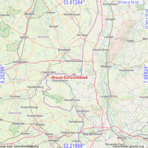
Nieuw-Schoonebeek GPS coordinates[2]
52° 38' 53.988" North, 6° 59' 9.996" East
| Map corner | latitude | longitude |
|---|---|---|
| Upper-left | 53.07284°, | 6.28299° |
| Center: | 52.64833°, | 6.98611° |
| Lower-right: | 52.21966°, | 7.68924° |
| Map W x H: | 94.9×94.9 km | = 59×59mi |
| max Lat: | 53.48025° ⇑25.3% North |
| Nieuw-Schoonebeek: | 52.64833° |
| min Lat: | ⇓74.7% South 50.76917° |
| min Long | Nieuw-Schoonebe | max Long |
| 3.38611° | 6.98611° | 7.16528° |
| W 98.7%⇐ | ⇒1.3% E |
Elevation
Elevation of Nieuw-Schoonebeek is 17 m = 56 ft, and this is 2 m = 7 ft above average elevation for this country.
| Max E: |
203 m = 666 ft | 26.5% |
| Nieuw-Schoonebeek | 17 m 56 ft | |
| Avg. | 15 m = 49 ft | |
Min E: |
-6 m = -20 ft | 73.5% |
See also: Netherlands elevation on elevation.city.
Geographical zone
Nieuw-Schoonebeek is located in North temperate zone (between Tropic of Cancer and the Arctic Circle). Distance of this North polar circle is 1547.2 km =961.4 mi to North.| Distance of | km | miles | from Nieuw-Schoonebeek |
|---|---|---|---|
| North Pole | 4153.1 | 2580.6 | to North |
| Arctic Circle | 1547.2 | 961.4 | to North |
| Tropic Cancer | 3248 | 2018.2 | to South |
| Equator | 5853.9 | 3637.4 | to South |


Nearby cities:
15 places around Nieuw-Schoonebeek: (largest is in red/bold)
• Angelslo
15.3 km =9.5 mi,  344°
344°
• Ballast
17.3 km =10.7 mi,  278°
278°
• Barger-Oosterveld
13.7 km =8.5 mi,  352°
352°
• Bargeres
14.4 km =8.9 mi,  330°
330°
• Coevorden
16.6 km =10.3 mi,  274°
274°
• Dalen
16.5 km =10.3 mi,  289°
289°
• De Loo
16.8 km =10.4 mi, 278°
• Emmen
15.5 km =9.6 mi, 339°
• Emmerhout
15.8 km =9.8 mi, 348°
• Klazienaveen
8.4 km =5.2 mi,  1°
1°
• Nieuw-Dordrecht
11.2 km =7 mi, 353°
• Noordbarge
15.3 km =9.5 mi, 334°
• Schoonebeek
7 km =4.3 mi, 282°
• Veenoord
11.6 km =7.2 mi,  306°
306°
• Weiteveen
2.7 km =1.7 mi, 1°
Sources, notices
• [Note1] Compared only with cities in Netherlands existing in our database
• [Src1] Map data: © OpenStreetMap contributors (CC-BY-SA)
• [Src2] Other city data from geonames.org with taken over terms of usage.
• [Src3] Geographical zone / Annual Mean Temperature by Robert A. Rohde @ Wikipedia
