Schoonebeek geodata
Schoonebeek (Drenthe) is a populated place; located in Netherlands in Europe/Amsterdam (GMT+2) time zone. With population of 3,845 people, there are 614 cities with bigger population in this country. Compared to other cities in Netherlands, 75.1% of cities are located further ↓South; 96.7% of cities are located further ←West and 72.5% of cities have lower elevation than Schoonebeek. Note1


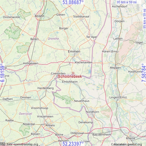
Schoonebeek GPS coordinates[2]
52° 39' 45" North, 6° 53' 4.992" East
| Map corner | latitude | longitude |
|---|---|---|
| Upper-left | 53.08687°, | 6.18159° |
| Center: | 52.6625°, | 6.88472° |
| Lower-right: | 52.23397°, | 7.58784° |
| Map W x H: | 94.8×94.8 km | = 58.9×58.9mi |
| max Lat: | 53.48025° ⇑24.9% North |
| Schoonebeek: | 52.6625° |
| min Lat: | ⇓75.1% South 50.76917° |
| min Long | Schoonebeek | max Long |
| 3.38611° | 6.88472° | 7.16528° |
| W 96.7%⇐ | ⇒3.3% E |
Elevation
Elevation of Schoonebeek is 16 m = 52 ft, and this is 1 m = 3 ft above average elevation for this country.
| Max E: |
203 m = 666 ft | 27.5% |
| Schoonebeek | 16 m 52 ft | |
| Avg. | 15 m = 49 ft | |
Min E: |
-6 m = -20 ft | 72.5% |
See also: Netherlands elevation on elevation.city.
Geographical zone
Schoonebeek is located in North temperate zone (between Tropic of Cancer and the Arctic Circle). Distance of this North polar circle is 1545.7 km =960.5 mi to North.| Distance of | km | miles | from Schoonebeek |
|---|---|---|---|
| North Pole | 4151.5 | 2579.6 | to North |
| Arctic Circle | 1545.7 | 960.5 | to North |
| Tropic Cancer | 3249.6 | 2019.2 | to South |
| Equator | 5855.5 | 3638.4 | to South |


Nearby cities:
15 places around Schoonebeek: (largest is in red/bold)
• Ballast
10.3 km =6.4 mi,  276°
276°
• Barger-Oosterveld
12.9 km =8 mi,  22°
22°
• Bargeres
11 km =6.8 mi,  358°
358°
• Coevorden
9.7 km =6 mi,  269°
269°
• Dalen
9.6 km =6 mi,  295°
295°
• De Loo
9.8 km =6.1 mi, 275°
• Emmen
13.1 km =8.1 mi,  6°
6°
• Klazienaveen
9.9 km =6.2 mi,  46°
46°
• Nieuw-Dordrecht
11.1 km =6.9 mi,  30°
30°
• Nieuw-Schoonebeek
7 km =4.3 mi,  102°
102°
• Noordbarge
12.2 km =7.6 mi,  0°
0°
• Sleen
13.3 km =8.3 mi,  335°
335°
• Steenwijksmoer
12.6 km =7.8 mi, 273°
• Veenoord
5.9 km =3.7 mi, 335°
• Weiteveen
7 km =4.3 mi,  80°
80°
Sources, notices
• [Note1] Compared only with cities in Netherlands existing in our database
• [Src1] Map data: © OpenStreetMap contributors (CC-BY-SA)
• [Src2] Other city data from geonames.org with taken over terms of usage.
• [Src3] Geographical zone / Annual Mean Temperature by Robert A. Rohde @ Wikipedia
