Kruisstraat geodata
Kruisstraat (North Brabant) is a populated place; located in Netherlands in Europe/Amsterdam (GMT+2) time zone. With population of 550 people, there are 1777 cities with bigger population in this country. Compared to other cities in Netherlands, 67.7% of cities are located further ↑North; 60.8% of cities are located further →East and 50.6% of cities have higher elevation than Kruisstraat. Note1


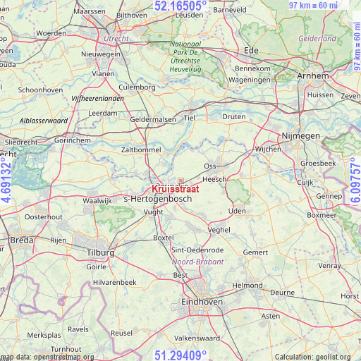
Kruisstraat GPS coordinates[2]
51° 43' 54.012" North, 5° 23' 39.984" East
| Map corner | latitude | longitude |
|---|---|---|
| Upper-left | 52.16505°, | 4.69132° |
| Center: | 51.73167°, | 5.39444° |
| Lower-right: | 51.29409°, | 6.09757° |
| Map W x H: | 96.8×96.8 km | = 60.1×60.1mi |
| max Lat: | 53.48025° ⇑67.7% North |
| Kruisstraat: | 51.73167° |
| min Lat: | ⇓32.3% South 50.76917° |
| min Long | Kruisstraat | max Long |
| 3.38611° | 5.39444° | 7.16528° |
| W 39.2%⇐ | ⇒60.8% E |
Elevation
Elevation of Kruisstraat is 6 m = 20 ft, and this is 9 m = 30 ft below average elevation for this country.
| Max E: |
203 m = 666 ft | 50.6% |
| Avg. | 15 m = 49 ft | |
| Kruisstraat | 6 m = 20 ft | |
Min E: |
-6 m = -20 ft | 49.4% |
See also: Netherlands elevation on elevation.city.
Geographical zone
Kruisstraat is located in North temperate zone (between Tropic of Cancer and the Arctic Circle). Distance of this North polar circle is 1649.2 km =1024.8 mi to North.| Distance of | km | miles | from Kruisstraat |
|---|---|---|---|
| North Pole | 4255 | 2643.9 | to North |
| Arctic Circle | 1649.2 | 1024.8 | to North |
| Tropic Cancer | 3146.1 | 1954.9 | to South |
| Equator | 5752 | 3574.1 | to South |


Nearby cities:
15 places around Kruisstraat: (largest is in red/bold)
• 's-Hertogenbosch
7.2 km =4.5 mi,  239°
239°
• Alem
7.1 km =4.4 mi,  329°
329°
• Amsteleind
8.2 km =5.1 mi,  61°
61°
• Berlicum
6 km =3.7 mi,  176°
176°
• De Rompert
5.6 km =3.5 mi,  252°
252°
• Den Dungen
7.6 km =4.7 mi,  191°
191°
• Geffen
4.9 km =3 mi,  79°
79°
• Heeseind
2 km =1.2 mi, 76°
• Heihoek
7.8 km =4.8 mi,  66°
66°
• Kerkdriel
6.1 km =3.8 mi,  317°
317°
• Maren-Kessel
7.1 km =4.4 mi,  359°
359°
• Middelrode
7.7 km =4.8 mi,  167°
167°
• Molenhoek
2.9 km =1.8 mi,  218°
218°
• Orthen
6.8 km =4.2 mi, 245°
• Velddriel
7.6 km =4.7 mi,  303°
303°
Sources, notices
• [Note1] Compared only with cities in Netherlands existing in our database
• [Src1] Map data: © OpenStreetMap contributors (CC-BY-SA)
• [Src2] Other city data from geonames.org with taken over terms of usage.
• [Src3] Geographical zone / Annual Mean Temperature by Robert A. Rohde @ Wikipedia
