Ysselsteyn geodata
Ysselsteyn (Limburg) is a populated place; located in Netherlands in Europe/Amsterdam (GMT+2) time zone. With population of 2,260 people, there are 900 cities with bigger population in this country. Compared to other cities in Netherlands, 81.5% of cities are located further ↑North; 64.2% of cities are located further ←West and 89.8% of cities have lower elevation than Ysselsteyn. Note1


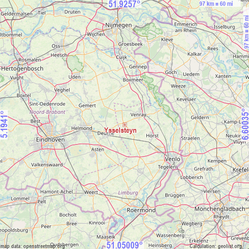
Ysselsteyn GPS coordinates[2]
51° 29' 24" North, 5° 53' 49.992" East
| Map corner | latitude | longitude |
|---|---|---|
| Upper-left | 51.9257°, | 5.1941° |
| Center: | 51.49°, | 5.89722° |
| Lower-right: | 51.05009°, | 6.60035° |
| Map W x H: | 97.4×97.4 km | = 60.5×60.5mi |
| max Lat: | 53.48025° ⇑81.5% North |
| Ysselsteyn: | 51.49° |
| min Lat: | ⇓18.5% South 50.76917° |
| min Long | Ysselsteyn | max Long |
| 3.38611° | 5.89722° | 7.16528° |
| W 64.2%⇐ | ⇒35.8% E |
Elevation
Elevation of Ysselsteyn is 33 m = 108 ft, and this is 18 m = 59 ft above average elevation for this country.
| Max E: |
203 m = 666 ft | 10.2% |
| Ysselsteyn | 33 m 108 ft | |
| Avg. | 15 m = 49 ft | |
Min E: |
-6 m = -20 ft | 89.8% |
See also: Netherlands elevation on elevation.city.
Geographical zone
Ysselsteyn is located in North temperate zone (between Tropic of Cancer and the Arctic Circle). Distance of this North polar circle is 1676 km =1041.4 mi to North.| Distance of | km | miles | from Ysselsteyn |
|---|---|---|---|
| North Pole | 4281.9 | 2660.6 | to North |
| Arctic Circle | 1676 | 1041.4 | to North |
| Tropic Cancer | 3119.2 | 1938.2 | to South |
| Equator | 5725.2 | 3557.5 | to South |


Nearby cities:
15 places around Ysselsteyn: (largest is in red/bold)
• America
8.2 km =5.1 mi,  136°
136°
• Brabander
7.1 km =4.4 mi,  43°
43°
• Brukske
7.5 km =4.7 mi,  62°
62°
• Castenray
9.5 km =5.9 mi,  90°
90°
• De Rips
9 km =5.6 mi,  317°
317°
• Leunen
6.1 km =3.8 mi,  68°
68°
• Merselo
4.9 km =3 mi,  25°
25°
• Milheeze
8.3 km =5.2 mi,  279°
279°
• Oostrum
9.3 km =5.8 mi, 62°
• Overloon
9.7 km =6 mi,  20°
20°
• Veltum
5.5 km =3.4 mi,  53°
53°
• Venray
6.6 km =4.1 mi, 54°
• Veulen
3.9 km =2.4 mi,  102°
102°
• Walsberg
6.8 km =4.2 mi,  255°
255°
• Zeilberg
6.7 km =4.2 mi,  234°
234°
Sources, notices
• [Note1] Compared only with cities in Netherlands existing in our database
• [Src1] Map data: © OpenStreetMap contributors (CC-BY-SA)
• [Src2] Other city data from geonames.org with taken over terms of usage.
• [Src3] Geographical zone / Annual Mean Temperature by Robert A. Rohde @ Wikipedia
