Walsberg geodata
Walsberg (North Brabant) is a section of populated place; located in Netherlands in Europe/Amsterdam (GMT+2) time zone. With population of 980 people, there are 1415 cities with bigger population in this country. Compared to other cities in Netherlands, 82.6% of cities are located further ↑North; 57.8% of cities are located further ←West and 85.2% of cities have lower elevation than Walsberg. Note1


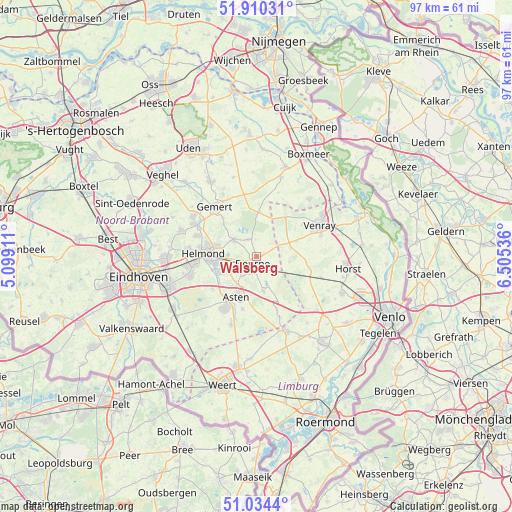
Walsberg GPS coordinates[2]
51° 28' 28.056" North, 5° 48' 8.064" East
| Map corner | latitude | longitude |
|---|---|---|
| Upper-left | 51.91031°, | 5.09911° |
| Center: | 51.47446°, | 5.80224° |
| Lower-right: | 51.0344°, | 6.50536° |
| Map W x H: | 97.4×97.4 km | = 60.5×60.5mi |
| max Lat: | 53.48025° ⇑82.6% North |
| Walsberg: | 51.47446° |
| min Lat: | ⇓17.4% South 50.76917° |
| min Long | Walsberg | max Long |
| 3.38611° | 5.80224° | 7.16528° |
| W 57.8%⇐ | ⇒42.2% E |
Elevation
Elevation of Walsberg is 27 m = 89 ft, and this is 12 m = 39 ft above average elevation for this country.
| Max E: |
203 m = 666 ft | 14.8% |
| Walsberg | 27 m 89 ft | |
| Avg. | 15 m = 49 ft | |
Min E: |
-6 m = -20 ft | 85.2% |
See also: Netherlands elevation on elevation.city.
Geographical zone
Walsberg is located in North temperate zone (between Tropic of Cancer and the Arctic Circle). Distance of this North polar circle is 1677.8 km =1042.5 mi to North.| Distance of | km | miles | from Walsberg |
|---|---|---|---|
| North Pole | 4283.6 | 2661.7 | to North |
| Arctic Circle | 1677.8 | 1042.5 | to North |
| Tropic Cancer | 3117.5 | 1937.1 | to South |
| Equator | 5723.4 | 3556.4 | to South |


Nearby cities:
15 places around Walsberg: (largest is in red/bold)
• Asten
8.7 km =5.4 mi,  205°
205°
• Bakel
5.4 km =3.4 mi,  306°
306°
• De Mortel
9.8 km =6.1 mi,  318°
318°
• De Rips
8.4 km =5.2 mi,  3°
3°
• Helmond
9.8 km =6.1 mi,  274°
274°
• Heusden
10.4 km =6.5 mi,  194°
194°
• Lierop
10.5 km =6.5 mi,  234°
234°
• Liessel
6.9 km =4.3 mi,  169°
169°
• Merselo
10.7 km =6.6 mi,  54°
54°
• Milheeze
3.4 km =2.1 mi,  332°
332°
• Ommel
6.7 km =4.2 mi, 213°
• Veulen
10.5 km =6.5 mi,  85°
85°
• Vlierden
4.5 km =2.8 mi,  222°
222°
• Ysselsteyn
6.8 km =4.2 mi,  75°
75°
• Zeilberg
2.5 km =1.6 mi,  152°
152°
Sources, notices
• [Note1] Compared only with cities in Netherlands existing in our database
• [Src1] Map data: © OpenStreetMap contributors (CC-BY-SA)
• [Src2] Other city data from geonames.org with taken over terms of usage.
• [Src3] Geographical zone / Annual Mean Temperature by Robert A. Rohde @ Wikipedia
